R6
Caideros de Tauro - La Solana
Conditions: Optimum. Good signposting and good state of conservation. Be careful on the platform (in the Palmarete area), because the path narrows, on the edge of the cliff.

Features
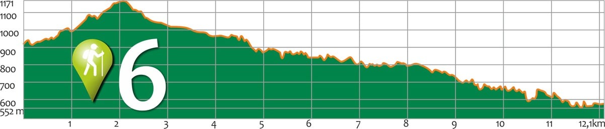
12,1 km
Distance
5:30h
Duration
Moderate
Effort
Descripción
Section A: Salto del Perro Dam -Degollada de Las Lapas
It starts on the road from Ayacata to Barranquillo Andrés (past the Las Niñas dam and the Cruz de San Antonio) or from the Mogán bank via Albarianes. The entrance to the path is clearly marked by a cairn. We start the ascent up the Tauro Mountain until we reach the Fuente del Durazno (a wide esplanade that opens up at a bend in the path). From this point, the zigzagging ascent takes us to the summit, with the option of approaching the Almogarén or Tagororor, along a path on our left. The route continues gently downhill to Degollada de Las Lapas, where there is an old abandoned forestry house used as a shelter for rangers and shepherds. This pass is a crossroads of paths: to the SW, the path to the Llanos del Guirre (Laderones/Molino de Viento, Hoya del Salitre) and to the E, leaving behind a first milestone next to the house, we come to another milestone, some two hundred metres along the Cañada de la Salvia, which points us in two directions: heading E, we connect with the path to Cortadores, and heading S, we head towards the Llanos de Gamona.
Section B: Degollada de Las Lapas – Degollada de Cortadore:
We follow the signs for Cortadores to the E, and soon the impressive view of the Tauro waterfalls appears before us. We descend along a wide path through pine woods towards the caidero Colorado and continue gently down towards the caidero del Laurel. We come across a water channel, be careful not to confuse it with the path, and turn south along the path that leaves the channel on our right and the cliff overlooking the Arguineguín ravine on the left, until we reach Cortadores.
At the edge of the ravine we find the signs to La Solana and start the path down in a N-NE direction.
Section C: Degollada de Cortadores – La Solana
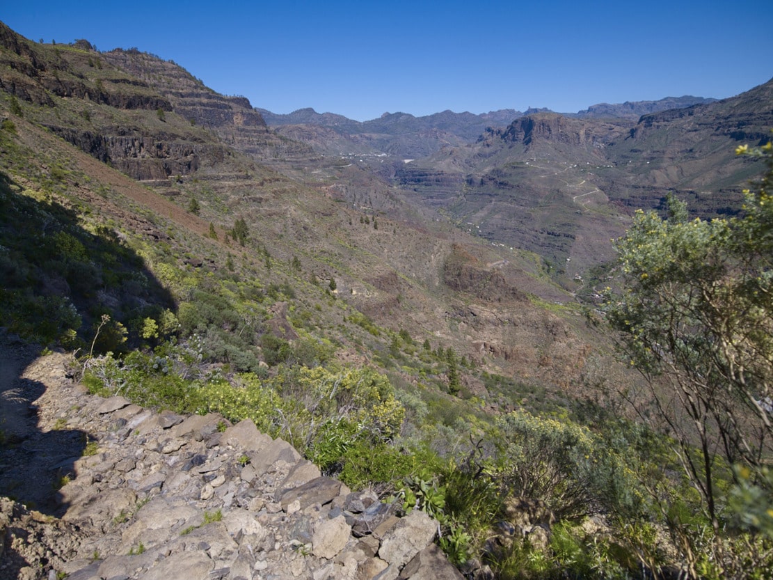
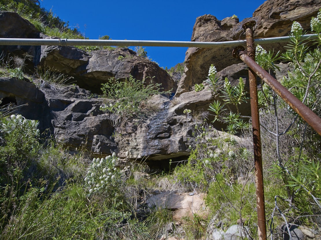
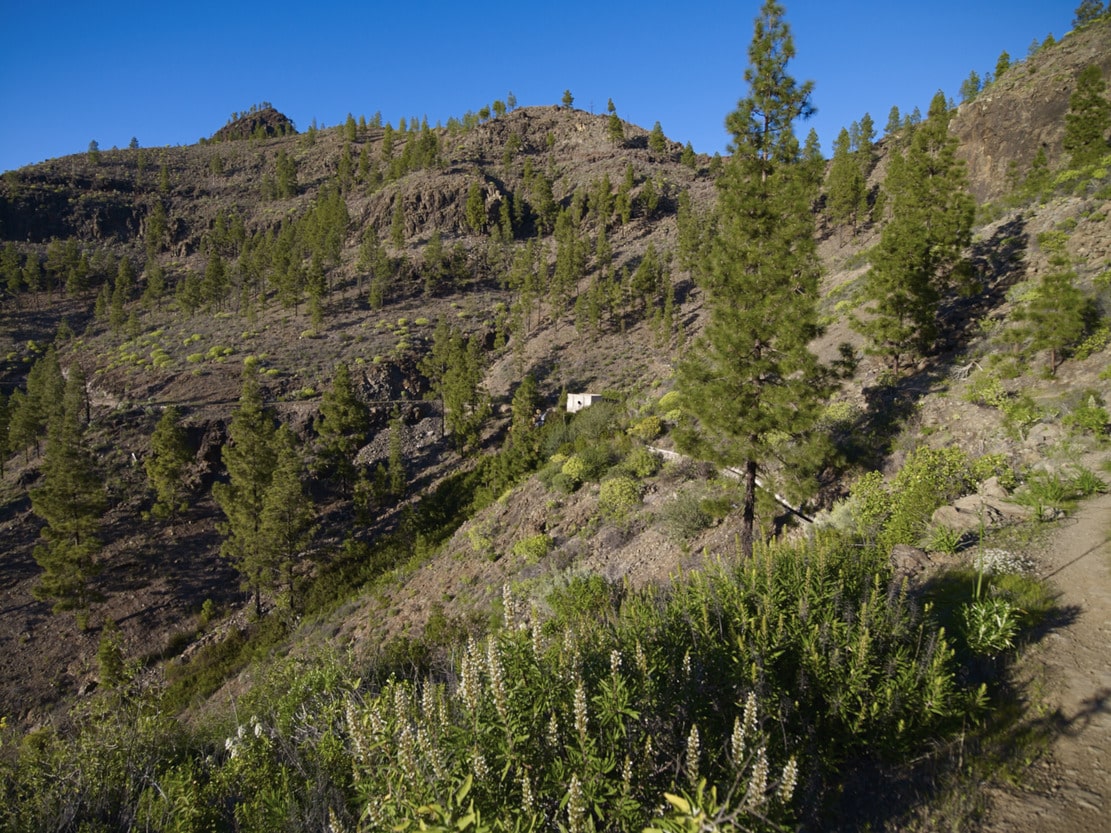
We start to descend a small slope, which is paved later in a zigzag. The path is clear and wide, except for some sections with thick vegetation (reeds and rushes), and a small narrowing in a rocky area: be careful on the platform and in another part of the path that crosses an area of debris. Before a small ravine, we have to negotiate large boulders and a pipe in the middle of the path. We then reach a fruit farm with a house on the top and a track that goes up from the main road. Near the house there is a milestone that marks the path to the left to continue on the flat, between pines and cactus trees. A little further on we join the Arguineguin-Cercados de Espino-Soria road, approximately one kilometre from Barranquillo Andrés.
Interpretation:
We leave the Salto del Perro dam behind us, to take the path that climbs Mt. de Tauro. Early in the morning, the mountain will appear to us like a sleeping giant that is beginning to wake up; the lower half in shadow and the upper half in reddish colour, in contrast with the bright green of the pines, due to the sunrise.
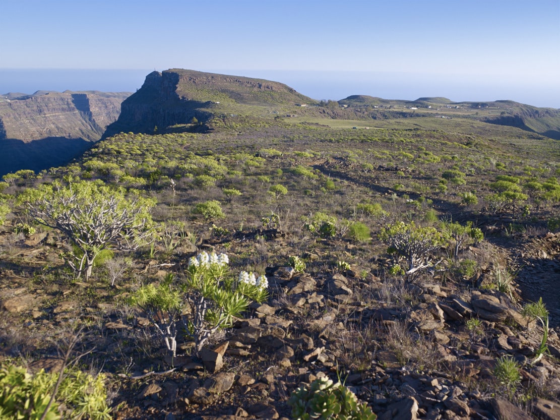
When we reach the top of the Fuente del Durazno, we can stop for a moment to stretch out and enjoy a magnificent panoramic view (almost circular) crowned by the head of Mogán Bank, with the Mt. de Aslobas and the Teide in the background up to the Santidad ramp, to the SE. In the foreground, filling the space between the Inagua-Ojeda-Pajonales Massif and the Tauro Ramp, we can see the Majada Alta plains.
We continue our ascent to the mountain along a relatively narrow path, first among scrubland (cardonal-tabaibal) and, as we approach the summit, among pine trees. The “lágrimas de la virgen”, with their characteristic little white flowers, stand out in the undergrowth. Witness to the forestry activity of the past, on the left of the path you will find the remains of a pitch oven, where the resin from the bark of the pine tree was used to obtain pitch or pitch for caulking ships. Near the summit, we can also make out the Guguy Massif, with the Hogarzales Mountain and the Cedro Mountain in the background towards La Aldea. If we visit the site of “La Iglesia de los Canarios” (we must be as respectful as possible), we will be able to understand the more than probable religious meaning of the site, due to the mysticism of the place, with a very beautiful panoramic view. Back on the path, from the stone wall that shows us the way, we can see towards the sea, the whole ramp that opens up in a fan, with the great plains interrupted (del Guirre, to the W, and Gamona to the E), by the incision of the ravines of Taurito and Tauro.
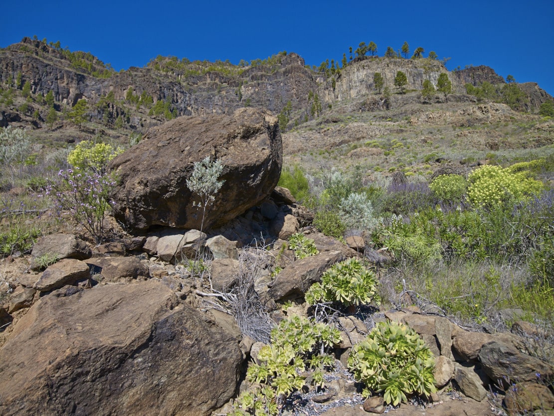
As we leave Mt. de Tauro, the pine forest opens up, leaving “patches” of pine trees, some of which are also loose or in pairs. And once again the bushes begin to appear; now the cardoncillos stand out, all along the ramp, with their characteristic greyish green colour. But the most curious and outstanding feature of the path are the flagstones, produced by the erosion of the trachyphonolitic material of the ramp, which will also accompany us on practically all the paths along the ramp, like a little music caused by the percussion of our footwear against the ground. This sound gives rise to the name of these rocks: phonolites (“fono”=sound, “lita”=stone).
After a moderately steep but short descent, you will reach the Degollada de Las Lapas. On the right hand side, some fifty metres to the W after the half-ruined house, there is a balcony or viewpoint towards Mogán (beware of the precipice and vertigo). A typical characteristic of the Degolladas is the whip of the wind that blows from one slope to the other, making the contrast between one slope and the other more noticeable.
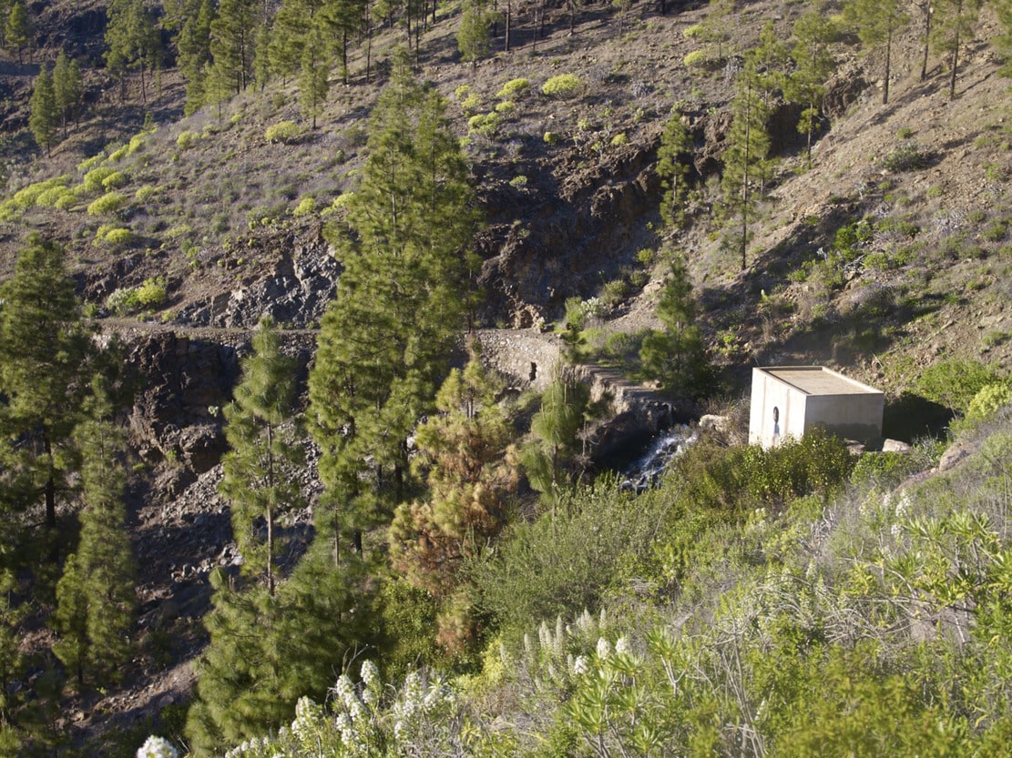
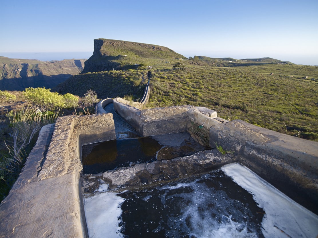
The path that leads from Degollada de las Lapas to Cortadores (from crossroads to crossroads), descends parallel to the canal that brings water from the Presa de las Niñas dam: an irrigation channel with walls made of vertical slabs stuck together, very typical and also used on farms for irrigation.
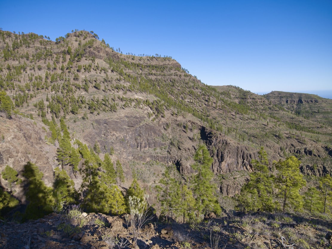
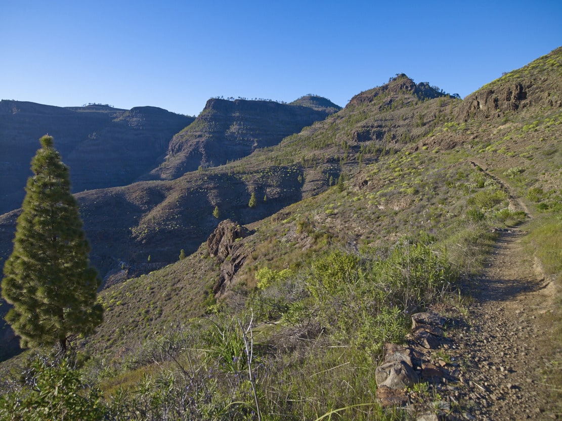
It runs along the entire edge of the headwaters of the Bco. de Tauro, first along an undulating path through the pine trees that borders the three tributaries that form the basin, and then across a small cobbled hill. The first section has a steep slope, saved by a zigzag, with impressive views towards the furrow covering the entire headwaters of the Tauro ravine.
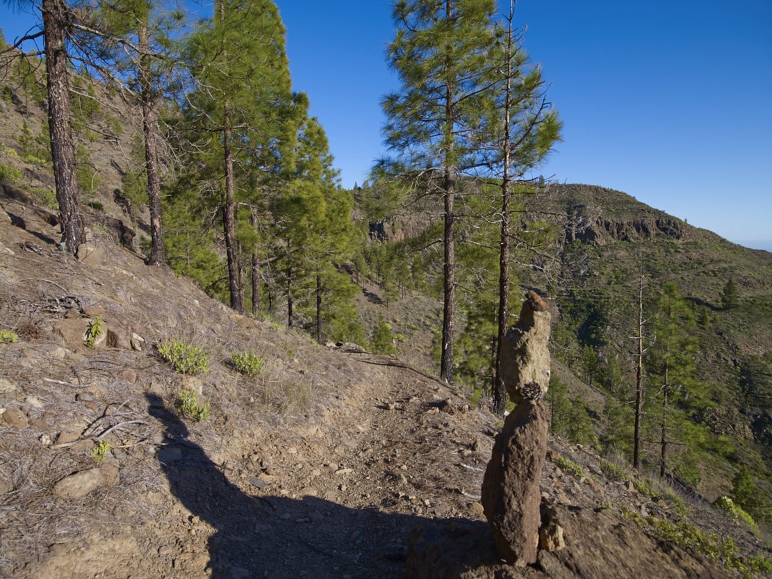
We arrive at another of the great plains of the ramp: Cortadores. Its name refers to the felling or cutting of pine trees. Nowadays there is an enormous solitary one, which provides good shade for walkers. In Cortadores there is a nucleus which can be accessed by track, for residential use and with active farms, threshing floors, alpendres, etc. Historically, this nucleus has always been important because it was home to the Tauro livestock herd. This livestock use may explain, in addition to the forest felling, the absence of significant vegetation, as it is a pasture area.
We are now on the E side of the Tauro Ramp, which looks towards the Arguineguín Bank. This is the beginning of the descent and the end of this route. A few metres from the start, the panoramic view opens up with the central summit of Gran Canaria in the background, the villages of Soria with the dam and Barranquillo Andrés, the Lomo de la Palma and the villages of La Higuerilla, Las Filipinas and Cercados de Espino in the Arguineguín riverbed.
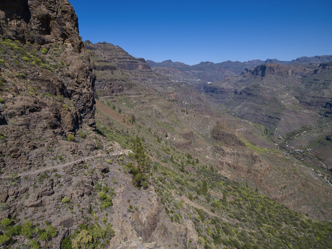
The first section of the path (El Palmarete) has cobbled parts (old bridle path). Then we continue along a path that follows the cliff, along a narrow platform. It is worthwhile to look in the direction of the summit and see the different terraces that erosion has created on Tauro Mountain. Looking up, we can see enormous bare walls like quarry blocks, with some rock species (cerrajas), taking advantage of the erosive cracks in them. Downwards (beware of vertigo) we can see the old path in disuse, very deteriorated due to the continuous landslides that also affect the current path. After leaving the platform, the path becomes smoother and we can enjoy the vegetation, which is more lush on this shady slope. It is worth trying to recognise them, because there is a great variety of all the species mentioned: rocky species, species of the degradation of the pine forest and the thermophile (dragon trees and junipers) and species of the Cardonal-Tabaibal. The path ends about 300 metres after the Finca de la Solana, a traditional and active farm. There you will see peacocks and African hens next to the fruit trees (please respect private property).