R7
La Solana - Los Roques
Condition: Good. Pay attention to the signpost to the Sao and the cairns in the Gurbia area. Caution on the descent down Morro del Pinillo (loose soil). Be aware of the scarce signposting at the end of the path, in case you want to do the route in the opposite direction.

Features
8,2 km
Distance
3:30h
Duration
Moderate
Effort

Description
Section A: La Solana-Degollada de Cortadores:
The path starts on the Arguineguín-Cercados de Espino-Soria road, approximately one kilometre from Barranquillo Andrés, and after about 300 m you will come to the La Soalna estate with its fruit trees, which you leave on the left. After a small gully, we have to negotiate large boulders and a pipe in the middle of the path. The path is clear and wide, except for some stretches with thick vegetation (reeds and rushes), and a small narrowing in a rocky area: be careful on the platform and in another part of the path that crosses an area of debris.
We start to climb up a small slope, paved later in a zigzag.
We reach the Degollada de Cortadores and head south, passing the house of the Comunidad de Regantes (Irrigation Community).
Section B: Degollada de Cortadores-El Sao:
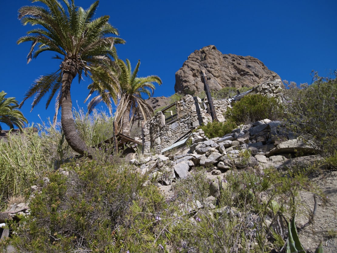
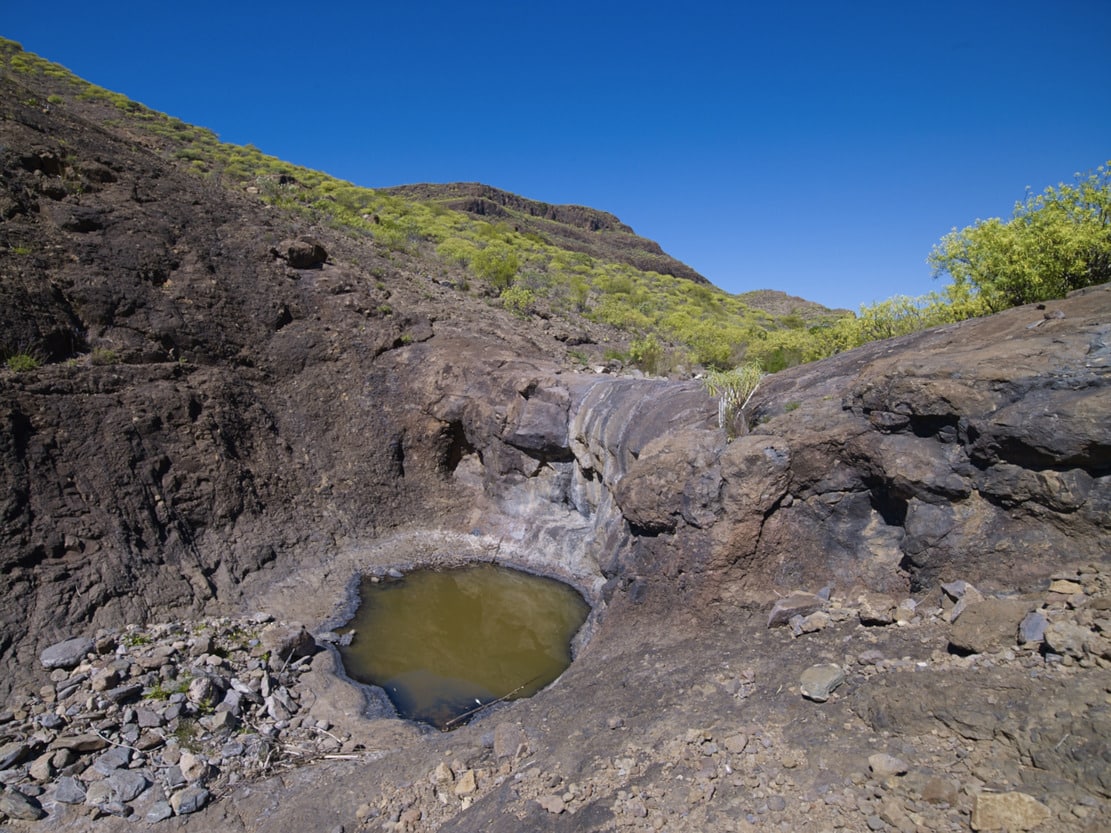
From Cortadores, take the dirt track heading S, coming from Arguineguín and/or Puerto Rico, which passes by the houses and farmland in the area, continuing along it for about 3.5 km. until Degollada de la Madera. At this point (signpost) and to the left (to the E), there is another abandoned track that leads to the start of the path, marked with cairns. The surface is slippery and with loose stones (be careful). When you reach Degollada de Gurbia, the zigzagging descent begins, through the Roques ravine. Along the way, you will see the walls of the old abandoned alpendres and you will reach a house on a steep cobbled path, which links up with an asphalted track of about 500 m. to the main road of Bco. de Arguineguín, crossing the centre of Sao.
Interpretation:
This route runs along a stretch of the E edge of the Tauro ramp (Arguineguín slope): from La Solana to the Sao.
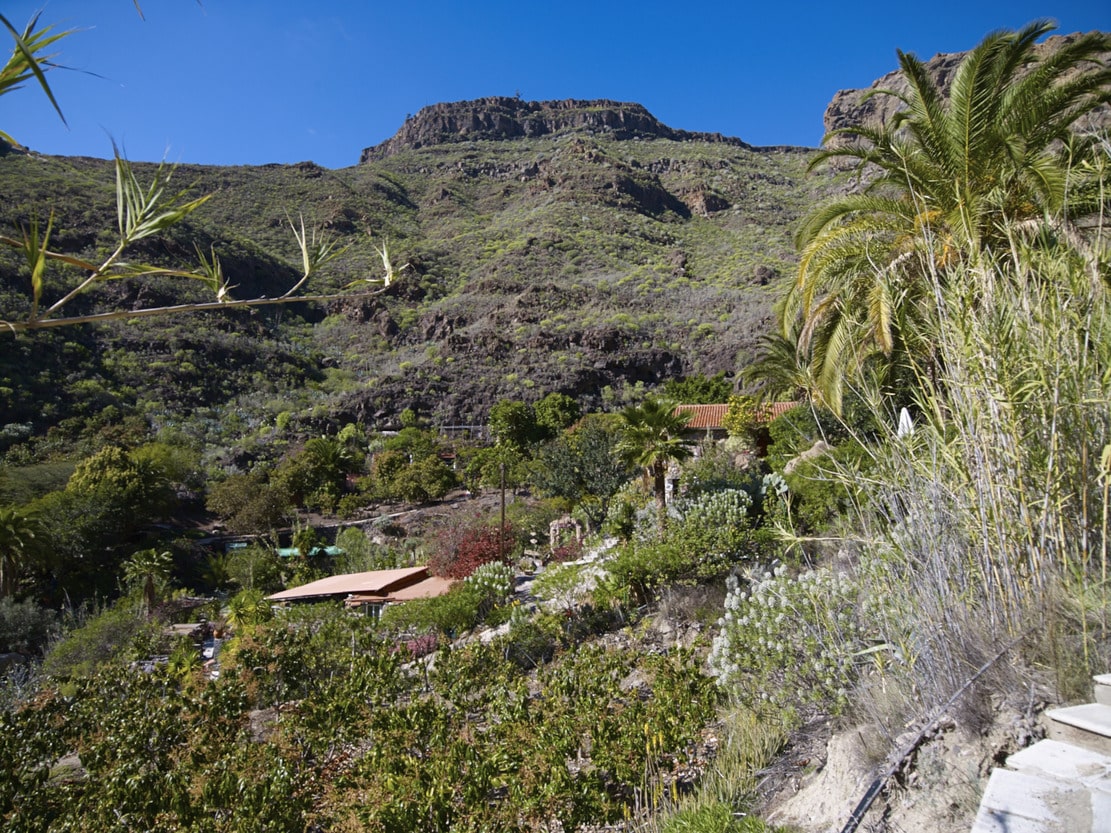
After about 300 metres we find the Finca de la Solana, a farm with traditional architecture that is still in use. On this farm we will see peacocks and African hens next to the fruit trees (please respect private property).
We can enjoy the vegetation, which is more lush on this shady slope. It is worth trying to recognise them, because there is a great variety of all the species mentioned: rock species, species of the degradation of the pine forest and the thermophile (dragon trees and junipers) and species of the Cardonal-Tabaibal.
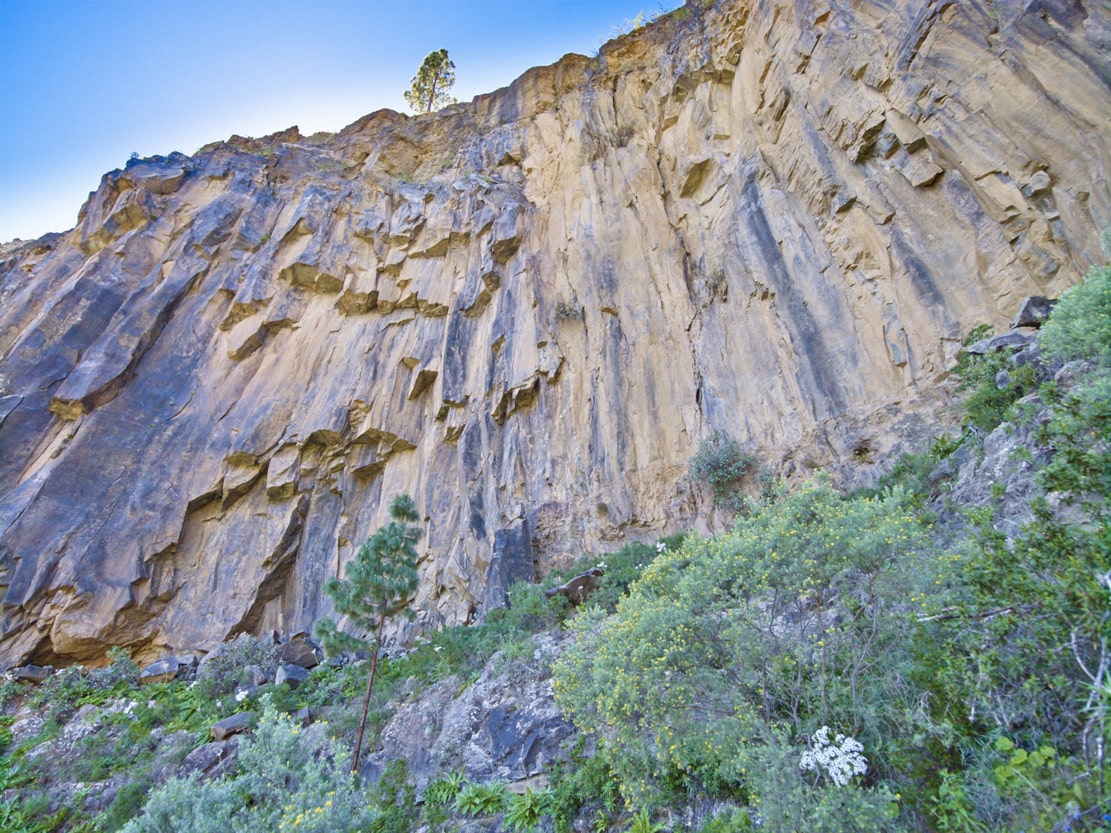
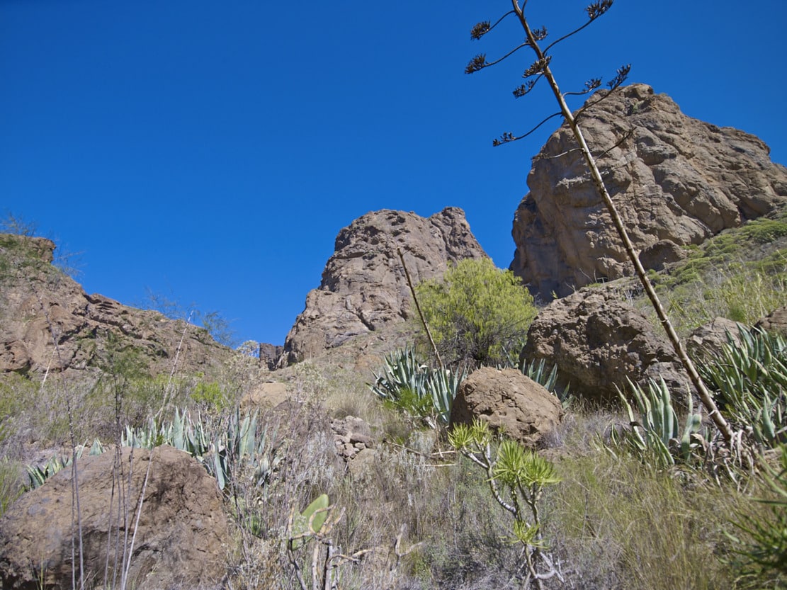
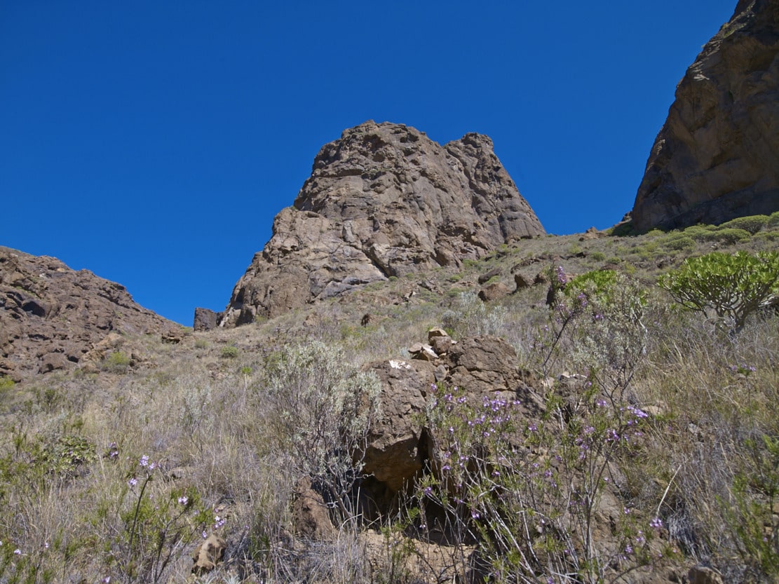
We then continue along a path next to the cliff, along a narrow platform. It is worthwhile to look in the direction of the summit and see the different terraces that erosion has created on Tauro Mountain. Looking up, we can see enormous bare walls like quarry blocks, with some rock species (cerrajas), taking advantage of the erosive cracks in them. Downwards (beware of vertigo) we can see the old path in disuse, very deteriorated due to the continuous landslides that also affect the current path.
The last section of the path (El Palmarete), has cobbled parts (old bridle path).
Perhaps the stretch of track may seem a little monotonous as it is a landscape area with little vegetation and little relief, up to Degollada de la Madera. -Again, the toponym refers to the felling and/or transport of wood; this was probably a rest or temporary storage area). On the way, we once again come across the channel coming from the Niñas dam (see route nº 6), crossed at some points by the track.
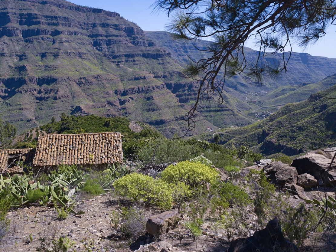
On leaving the tracks, the path descends gently towards Degollada de Gurbia. Along the way, in addition to the Cardonal-Tabaibal plant species already mentioned (especially groups of sweet Tabaibas), we can find another rare species, the reddish-coloured Sideritis sventenii (from the salvias group). Looking out over the Degollada, we can see the other side of the Arguineguín bank in front of us: the Lomos de Pedro Afonso. It also has very steep slopes, with large landslides. In Gurbia we can see one of the threshing floors of the area, very deteriorated, which indicates the old agricultural work. Despite the scarce soil and the slope, the area was used for dry farming (cereals). -The need for food and the scarcity of land and resources were greater at other times (Civil War, for example). Farmers would go up from Sao and other nearby villages to sow or harvest the crops, staying in the area for several days and taking refuge in the caves of Morro de Gurbia. The wheat was then loaded onto donkeys and taken to the Sao. Of all this, today only the remains of a few terraces remain, as the vegetation has repopulated the area.
From the threshing floor, the path takes on a steep slope to descend to the centre of the Sao houses.
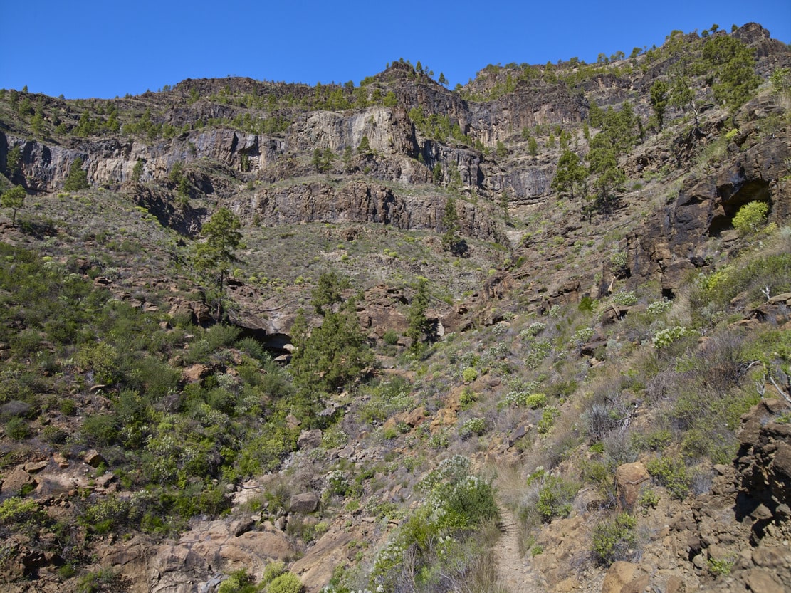
We will do so through the Los Roques ravine. These rocks or “morros” are Gurbia and Pinillo, which have been highlighted by differential erosion*. The name “Pinillo” refers to the former presence of pine trees in the area. In the ravine we can see more exuberant vegetation, typical of the ravine ecosystem. Despite the fact that we are in the Cardonal-Tabaibal bioclimatic zone, the gully beds and the difference in altitude allow the development of other species: balos, tarajales, palm trees, dragon trees, wild olive trees, willows, etc. The latter form veritable galleries in the watercourses through which the water flows. The toponym of Sao, which also exists in other parts of the island, probably refers to these willow groves. Nowadays, the predominant feature of this landscape is the citrus and tropical crop farms, as is the case in almost all the south and west of Gran Canaria.