R8
Barranquillo Andrés - Soria
Conditions: Pay special attention at the entrance to the path and in the Majada Alta area, due to poor signposting, as the path has stretches that are not in an optimal state of conservation. Take care with the stretches of loose earth to avoid slipping.

Features
10 km
Distance
4h
Duration
Moderate-High
Effort

Description
Section A: Barranquillo Andrés- Majada Alta:
We start from the road that climbs up next to the church and connects with a concrete track (be careful! with the entrances to farms and houses). We go up the latter towards a palm grove and continue along a dirt track that skirts the W side of the Montañón, on a steep slope until we reach a crossroads. Take the abandoned track that continues to the right until it ends in an area covered by vegetation (you will have to “discover” the milestone). Here the path starts up the ravine on the right bank, crossing a canal from which the path gets a little lost (pay attention to the signposting) until it passes to the left bank of the ravine and connects with a crossroads. We take the path on the left, crossing another canal that we left behind, to climb up to Degollada de Majada Alta. We see the signpost: to the left (SW) it directs us towards the Salto del Perro dam and to the right (NE) to the Las Niñas dam.)
Section B: Degollada de Majada Alta – Las Niñas Dam:
Easy to walk if the signposting is in good condition. A little further on you will see the Majada Alta caves. We then descend until we see some houses and join a track that comes from the Cruz de San Antonio. The boundary markers guide us to continue zigzagging and climbing gently until we reach the Alto de los Ceniceros. From here, we cross a canal and a small ravine to border the dam under the road and continue along a dirt track that takes us to the car park of the recreational area.
Section C: Las Niñas-Soria Dam:
From this point (recreational area), cross the tail of the dam in a SE direction and join the road that goes to the dam wall. Go downhill for a few metres (SW) until you reach the start of the path in a rocky area from where you can see the villages of Barranquillo Andrés and Soria. Descend zigzagging down an increasingly steep slope until you reach the Caideros de Soria (be careful with the wet ground). We continue (paying attention to the cairns) for quite a while until we connect with a downhill track, and we join the road that takes us to Soria (towards the W at the crossroads with the asphalt) near some houses.
Interpretation:
This route describes practically a circuit, passing by two of the dams (Soria and Las Niñas or Cueva de las Niñas), included in another well-known route: the “route of the dams”. The route starts at Barranquillo Andrés, one of the villages in the middle section of the Arguineguín Bank, at an altitude of 620 m. The path was used as a link between the two dams. The path was used as a link between the Bco. de Arguineguín and the Bco. de Mogán, passing the Salto del Perro dam and Albarianes. It was also used to reach the Llanos de Majada Alta, a grazing area, and the Presa de las Niñas dam.
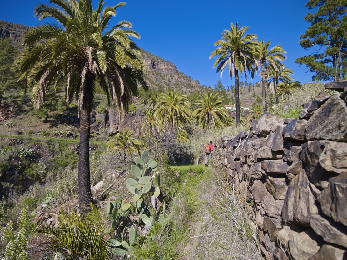
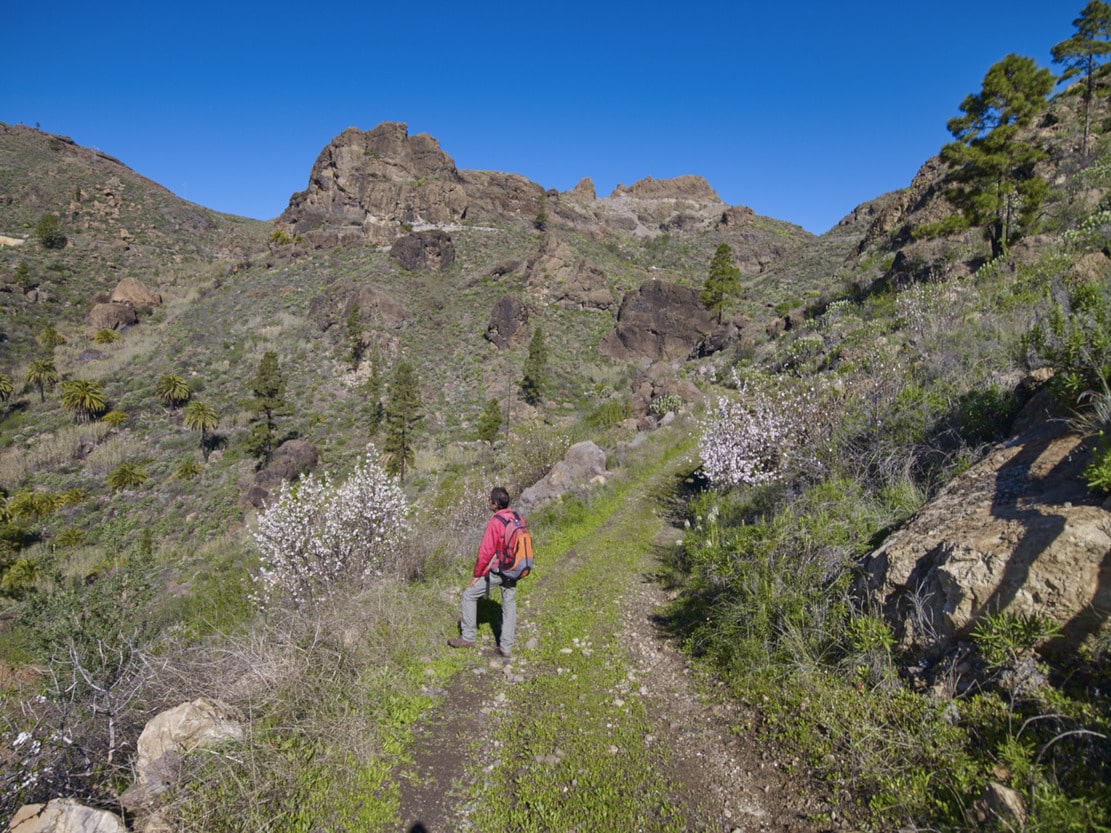
The first section to the Salto del Perro Dam, along the Cañada de la Mimbre, is very steep and has loose soil. It passes through farms and palm groves and abundant vegetation (ravine ecosystem, see route no. 7), in which the taginastes stand out. It is worth looking back as we ascend, to observe the panoramic view of the Arguineguín Bank, with its large walls (slopes).
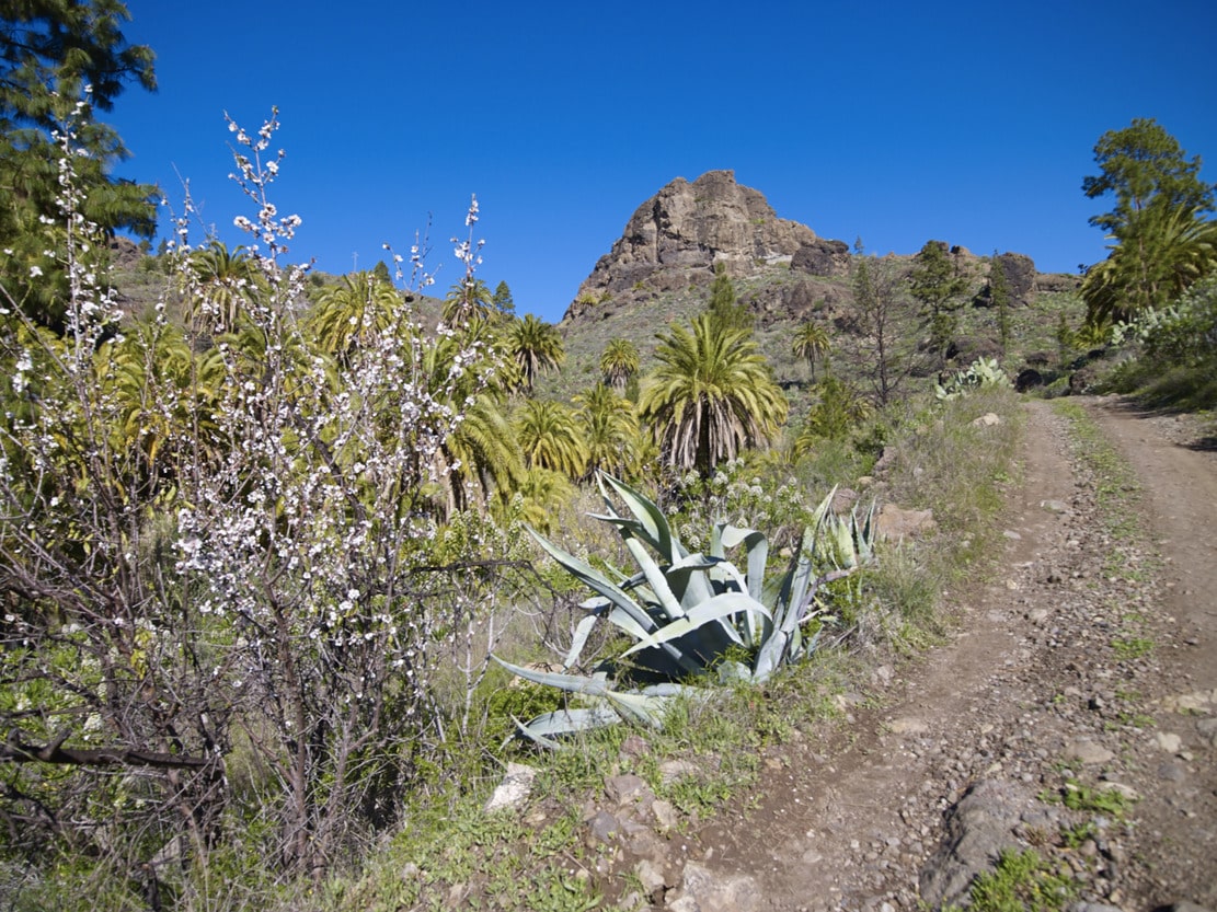
When we reach the area around the Salto del Perro dam, the space opens up, as does the vegetation. We then start walking towards the Cortijo de Majada Alta. This is a relatively flat area, whose origin lies in a filling of lithic breccia* type material, produced during the Roque Nublo Cycle (Pliocene, Tertiary Era).
The predominant use of this area has been and continues to be grazing. Proof of this is the scarcity of vegetation caused by cattle grazing*. Another important feature is the Majada Alta Caves, an archaeological site of great importance and therefore the first to be enclosed on the island, thanks to which its conservation has been achieved. According to the Guide to the Archaeological Heritage of Gran Canaria, it is a cave station, as anthropomorphic pictograms painted with almagre have been found inside a cave. There were also remains of aboriginal pottery and dry stone constructions in the vicinity, which constitute burial mounds.
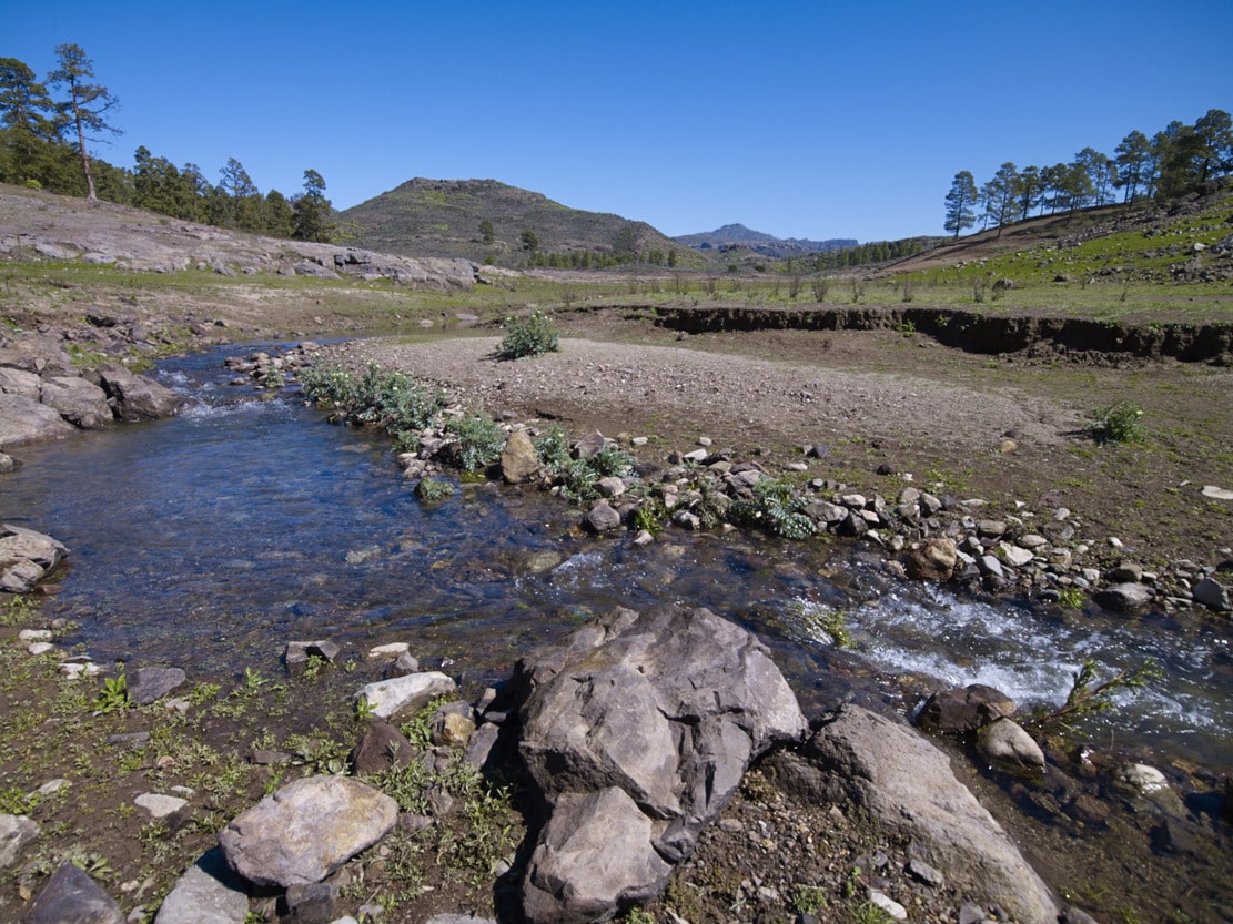
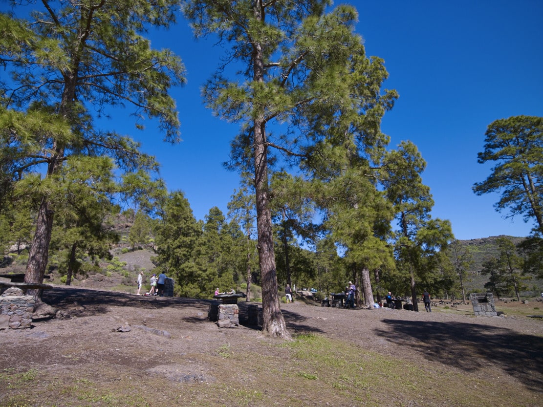
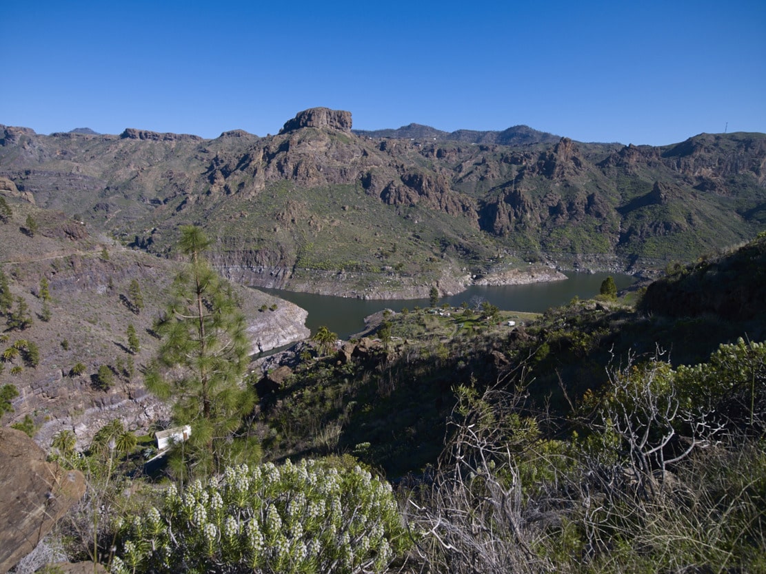
We reached the area of the Presa de las Niñas dam. This reservoir was built over a hanging ravine (the Caideros de Soria) by closing the fall with the wall. When the dam fills and overflows, the water falls through here directly into the Soria dam. These two dams and the Chira dam were built in this area of Gran Canaria because of the geomorphological conditions of the terrain: three large catch basins in impermeable rocky substratum, which does not allow water to infiltrate into the subsoil. They were built because of the need to obtain new water resources, due to the overexploitation of the aquifer* to supply a large quantity of water for the cultivation of bananas, to which was added the supply for tourism. The area around the dam is a recreational area, a crossroads of paths between those going to Inagua-Ojeda-Pajonales and Aldea de San Nicolás, those going to Mogán and Arguineguín and those going to or coming from the Cumbre.
The third section of the route covers the distance between this dam and the Soria dam, along the slope of the Cañada de La Perra, returning to the Arguineguín bank. It is a cobbled section (bridle path) which is very interesting from a botanical point of view. The path runs on a gentle slope, through lush vegetation, where endemic and autochthonous plant species are mixed with those introduced due to the agricultural exploitation of the area (abandoned terraces and threshing floors).
The vegetation is not exclusive to one bioclimatic level, but is mixed with the ecosystem of ravines (palm trees, wild olive trees, granadillos, veroles, etc.); with the scrub that replaces the pine forest (broom, broom, broom, broom, vinegar, etc.); with the Cardonal-Tabaibal (tabaibas, verodes, tajinastes, etc.) and with loose pine trees, almond trees, pitas, tuneras, etc.
A striking stretch of this path is the passage between the Caideros de Soria, where puddles form during the rainy season. This space stands out for the contrast of colours produced by the grey and black stone (the latter due to oxidation caused by water, in ignimbrites and lithic breccias of the First and Second Volcanic Cycle, respectively), together with the rock species that colonise the cliffs (cerrajas) and reeds.
This is the end of the route. Soria is an active rural settlement, although agricultural practice has declined (its oranges and wood-fired bread are famous) and a tourist attraction, due in part to its location in the upper area of the Arguineguín Bank and also to the existence of the dam. The Soria reservoir, the largest in Gran Canaria (40,288,625 million m3), was completed in the early 1970s. It closes the canyon of the Arguineguín ravine with a convex wall (instead of straight, to increase its resistance) made of concrete. From this point you can continue walking along the road towards Barranquillo Andrés, which is a short distance away, and thus complete the circuit.