R1
Veneguera - Cruz de Mogán
Conditions: Optimum. Good state of conservation, good signposting (except for the section from Casas de Veneguera to Hoya de la Salvia, due to the crossing of tracks). Caution in areas of loose soil to avoid falls.

Features
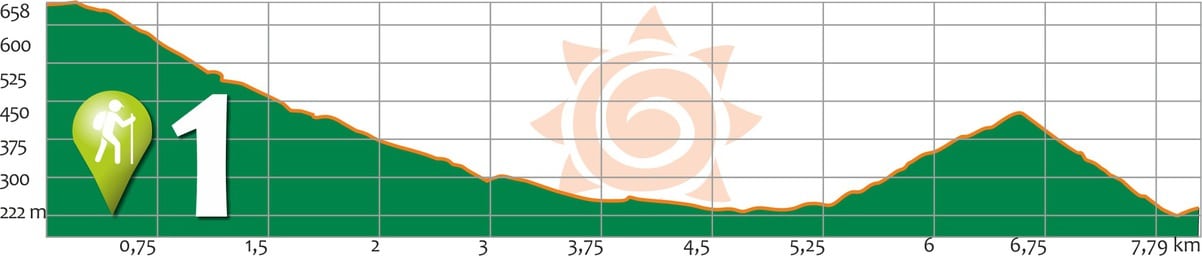
7,79 km
Distance
3:30h
Duration
Low-Moderate
Effort
Description
Section A: Degollada de Tasarte – Casas de Veneguera:
The route starts from the point on the C-810 road, called Degollada de Tasarte, where two different slopes can be distinguished: to the northwest (NW), the Barranco de Tasarte ravine and its hamlet, and to the southwest (SW), the Barranco de Veneguera ravine.
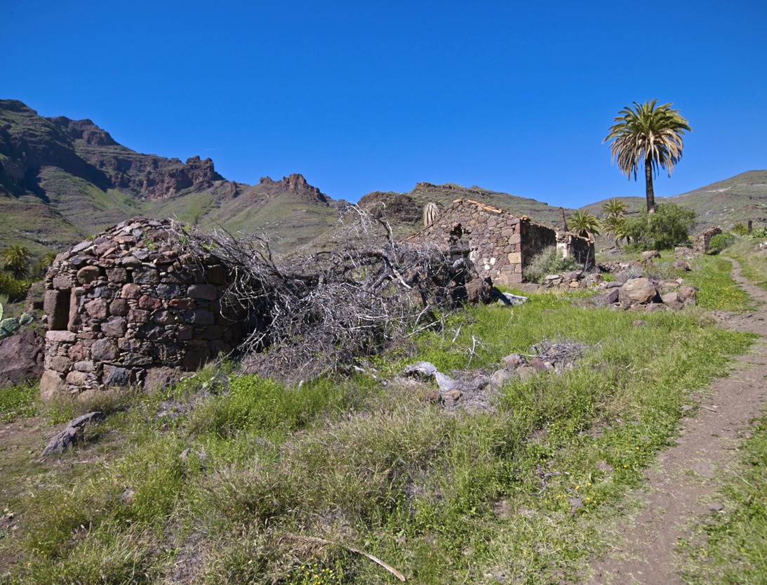
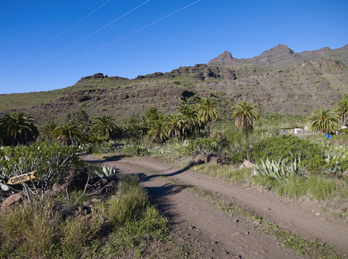
The cairn or signpost marks the beginning of the path, next to the Mogán municipality boundary panel. After descending a small slope, we continue zigzagging gently downhill along the Lomo del Camino towards the hamlet of La Cogolla. This is made up of several traditional Canarian houses amidst palm trees. A large carob tree stands out as a landmark, and its shade invites us to take a break along the way. A little further on, you will see an old, well-preserved bread oven.
We descend along the path, leaving it when we reach some beehives, where a dirt track begins. Continue along this track, and as you pass some demolished Canary Island houses, you can see part of a volcanic dike (a consolidated magma seam that fills a fissure in the substratum) on the right-hand slope of Bco. The route continues along the track until you reach the wastelands of Llanos del Gusano (a slightly steeper slope) and reach an area with fruit farms (El Riego, La Solana). The track continues until it reaches a warehouse in front of an impressive cardon tree, in the centre of Casas de Veneguera.
Section B: Casas de Veneguera – Cruz de Mogán-Mogán:
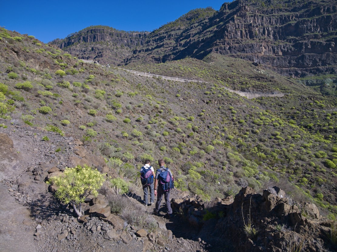
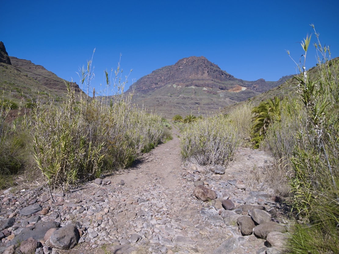
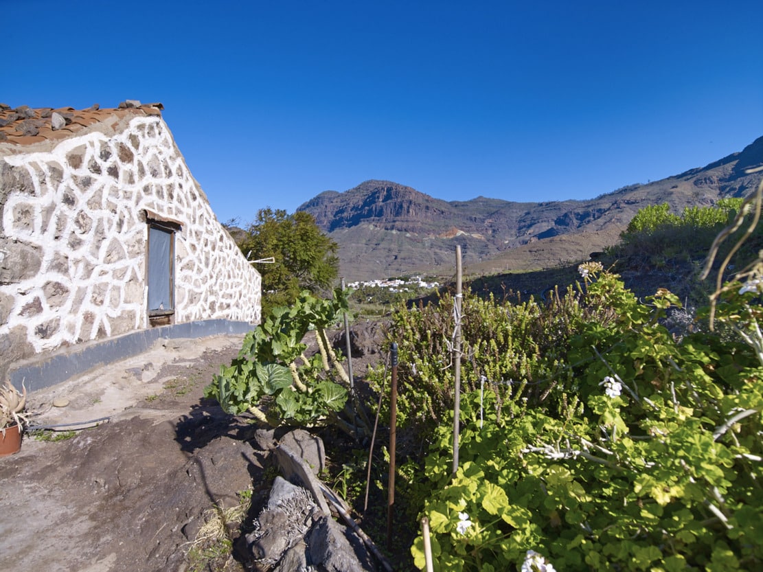
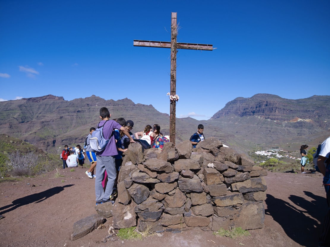
From the track that starts towards Playa de Veneguera, another track starts on the left, where the signpost is located. The route is in good traffic conditions and passes between some houses with cultivated land. Leaving a concrete track on the left, continue straight on until, a few metres further on, we turn off onto another track on the left under a house, which we leave on the right and reach a path that crosses a track that goes down to the bed of the ravine. Cross it and continue alongside palm trees, prickly pear and eucalyptus trees until you reach a traditional house with a gabled roof (Huerta Vieja). After about fifty metres the path continues to the left (pay attention to the signposting), where you reach a fairly dense palm grove. Further on it gets worse (abundant vegetation), at the Hoya de la Salvia. Then we zigzag up a clear, cobbled stretch until we reach the Cruz de Mogán.
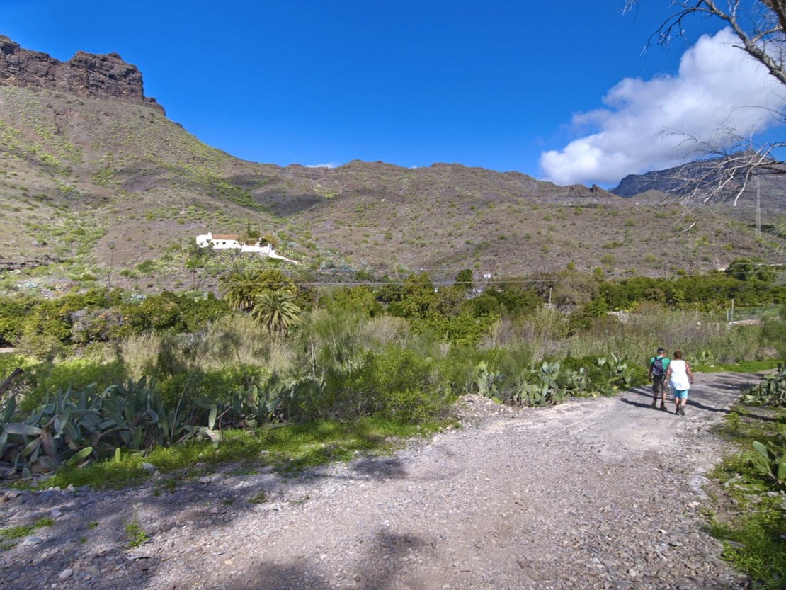
Descend towards Mogán via the Lomo de la Quinta. In some parts the terrain is somewhat slippery due to the loose materials. Others are paved and make the descent easier. After passing a threshing floor, the path ends next to a traditional house and you reach a track that crosses the bed of the ravine, in an area of fruit orchards (mango, papaya and fig trees), and connects with the C-812 road towards Playa de Mogán (signpost in front of the “casa del cura”, a traditional house, about 100 metres from the church of Mogán).
Interpretation:
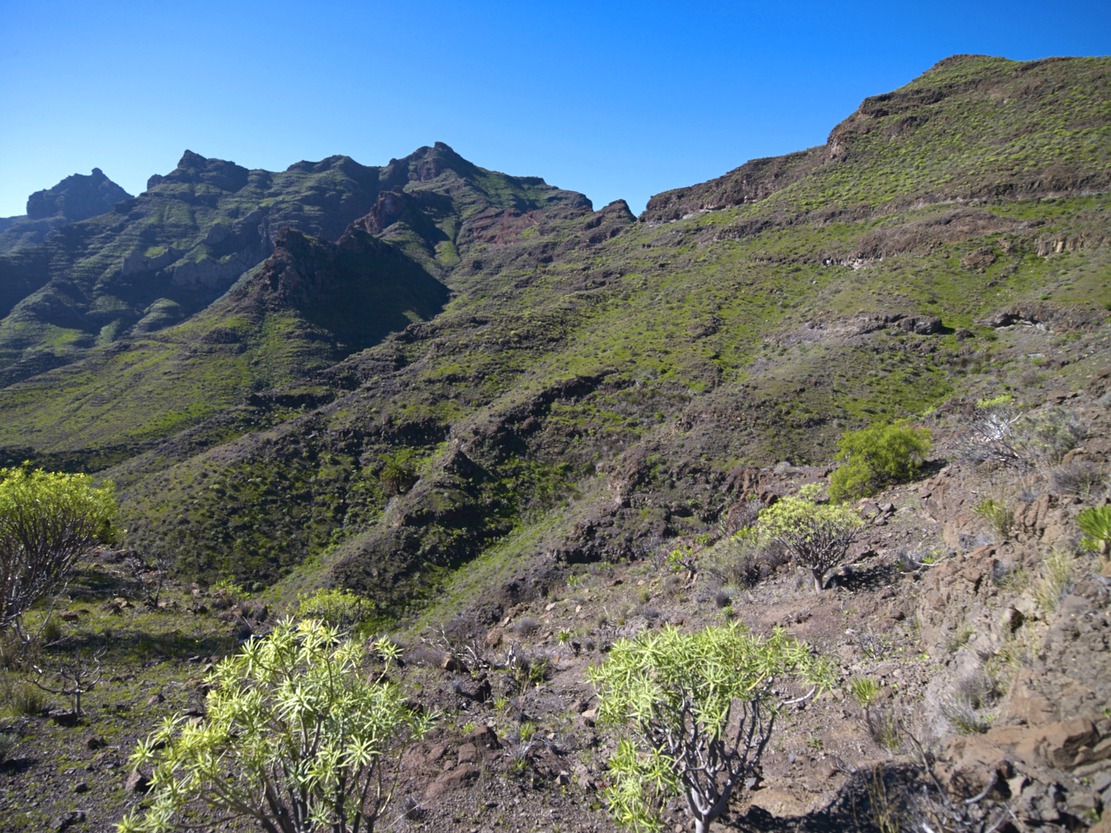
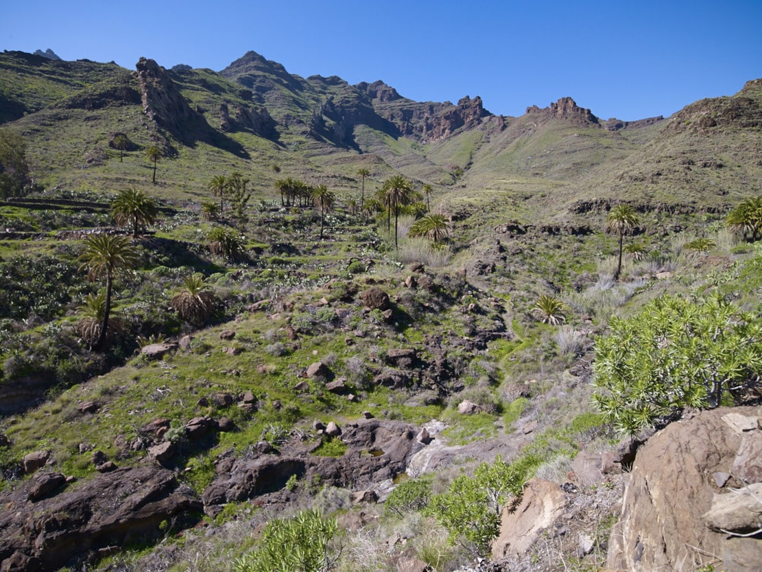
This route crosses practically in a straight line, from the Bco. de Veneguera to the Bco. de Mogán, crossing the dividing line or knife between the two: the Cruz de Mogán. At the Degollada de Tasarte (start), we enjoy a magnificent panoramic view: we leave Tasarte and La Aldea behind us to the NW; ahead, to the SW (Veneguera) we can see the crest of Los Molinos, whose place names (Cortijo de los Molinos, Corral de…) refer to the settlement in this area. ), refer to the establishment in this area in the past of one of the most important livestock (goat) farms in the region; the Risco de las Tederas (Los Azulejos); in front, behind the Lomo de Veneguera and the Cruz de Mogán, the majestic profile of the Tauro Ramp and at the bottom of the ravine, first the Finca de la Cogolla and to the right, before the Casas de Veneguera, some prominent rocks that form part of a dike that crosses the ravine from Los Molinos and continues through Los Quemados towards the Llanos de Ojeda (Inagua).
The route continues down the ravine in the middle of a leafy Cardonal-Tabaibal, with magnificent large cactus trees. Associated with these and seeming to seek shelter, the Cornicales grow. If you look closely you may be able to see the caterpillar of the Tabaiba Sphinx, feeding on the branches of the Tabaibas. Alongside the tabaibas and cardones, many shrubs grow, including verodes, taginastes balos, balillos, and tasaigos.
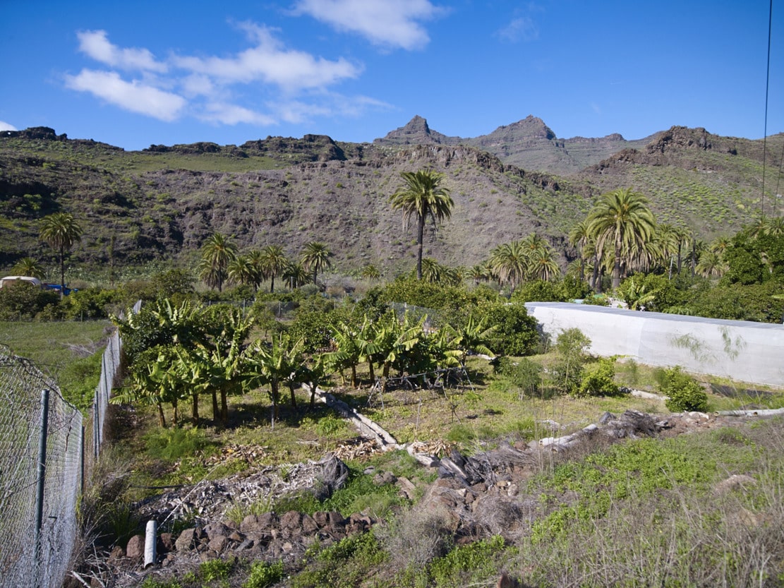
Looking up to the sky, it is more than likely to be able to spot kestrels gliding. But we can also find other plant species introduced and associated with the agricultural exploitation; prickly pears and pitas that were used to delimit the plots and carob trees in the old Finca de la Cogolla, witness of the occupation that this enclave has had since prehistoric times and later with the first settlers grouped in small hamlets. Before reaching the Casas de Veneguera, we will pass by farms of tropical crops (avocado and papaya) and citrus fruits, which show us the current development of export agriculture, with its own infrastructure (warehouses, wells, irrigation systems, etc.); all of this is the result of great human effort over generations, samples of which can be seen along the ravine as far as the Playa de Veneguera. We will also find traces of commercial farms (bananas and tomatoes) on farms that are still in use.
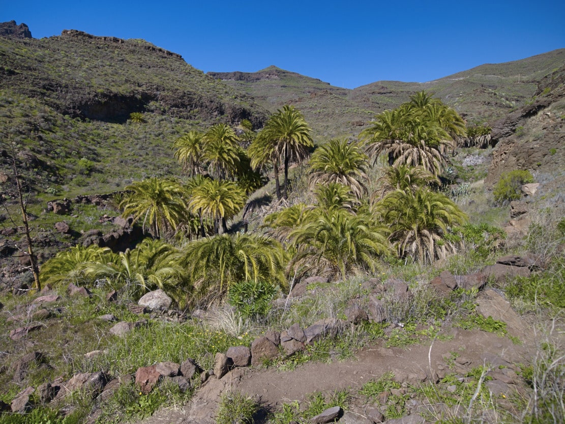
We cross the rural village of Casas de Veneguera to start the ascent towards Mogán, first between houses and farms (Huerta Vieja) and then through a small ravine (Hoya de la Salvia) full of palm trees, wild olive trees, tarajales, rushes, reeds and Moorish sage. The paved section of the Lomo de Las Tosquillas indicates the use of the path, in former times, as a passage for beasts of burden, being then a bridle path. We arrive at the Cruz de Mogán, which is a resting and meeting place for the inhabitants of Veneguera and Mogán, particularly during the Fiesta de San Antonio el Chico, when the cross is lit and lit. In addition, this small cut-throat area allows us to look towards both villages. Towards Veneguera, we can now see the whole of the path and an overall view of the head of the valley and its curious L-shape, with a 90º turn to the NW, caused by the presence of the Inagua-Ojeda-Pajonales Massif, which prevents it from digging completely straight ahead, although it does manage to bite into the massif. Thus, before running parallel to the ravines of Mogán to the E and Los Secos to the W after the houses of Veneguera, its headwaters are divided into two parts: a branch that goes as far as Alsándara and another, separated from the former by the breakwater that starts at Mt. de Ojeda (the Alto de las Tederas), which begins at the Tasarte cut.
Towards Mogán, we can see the whole valley with its great walls, from Albarianes and Pie de la Cuesta to El Cercado, dotted with farms along its course and in the foreground the centre of Mogán, which we will finally reach, descending the Lomo de la Quinta, mainly among sea rosemary, tabaibas, verodes, balos, Moorish sage and gorse. We can also see the old threshing floors where wheat was threshed.