R3
Hoya del Salitre - Laderones
Conditions: Optimum. Good signposting (excessive on the first stretch) and good state of conservation. Be careful on the descent from Laderones to Molino de Viento, due to the almost vertical slope, slippery rocks (wet ground) and loose stones in the zigzag (dry ground).

Features
6,92 km
Distance
3:30h
Duration
Moderate-High
Effort

Description
We advise you to follow this route in the direction indicated because the descent through the Hoya del Salitre can be uncomfortable or difficult, and if the midday and/or afternoon sun catches you, you could have difficulties due to excessive sun exposure (La Hoya faces west).
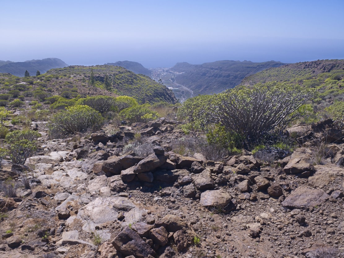
This route starts on the C-812 road in the direction of Mogán, in the village of El Cercado. After crossing a group of houses and farms on an asphalted road, continue along a dirt track to the start of the path (signpost). We zigzag up through the Hoya del Salitre. It is a somewhat stony stretch where we cross several ravines in the direction of Lomo de las Puntas. We pass through the Cañada de los Parados to climb up to the Llano de los Revolcadores, where the path is marked by cairns. We “Rampeamos” a good while on a gentle slope, accompanied by impressive specimens of sweet Tabaiba. Passing the Puntón de Las Leñas Buenas, which stands out on the escarpment overlooking the Mogán valley, we continue along the western side of the Tauro ramp until we reach a crossroads where there is a small sheepfold (circular stone wall), which marks the descent through the Laderones pass. Heading upwards, we reach the crossroads that connects us from the Llanos del Guirre with the path to Degollada de las Lapas, to the N, or with the one that goes to the Llanos de Gamona, through the Charcas de Taurito, to the E.
From the sheepfold, you descend steeply down a paved path. Then it flattens out a little on the platform, before zigzagging down again (pay attention to the strain on your knees and feet). The path ends at a dirt track (signpost) that connects with an asphalted section (approx. 500 m), which leads to various farms and the C-812 road, in the village of Molino de Viento.
Interpretation:
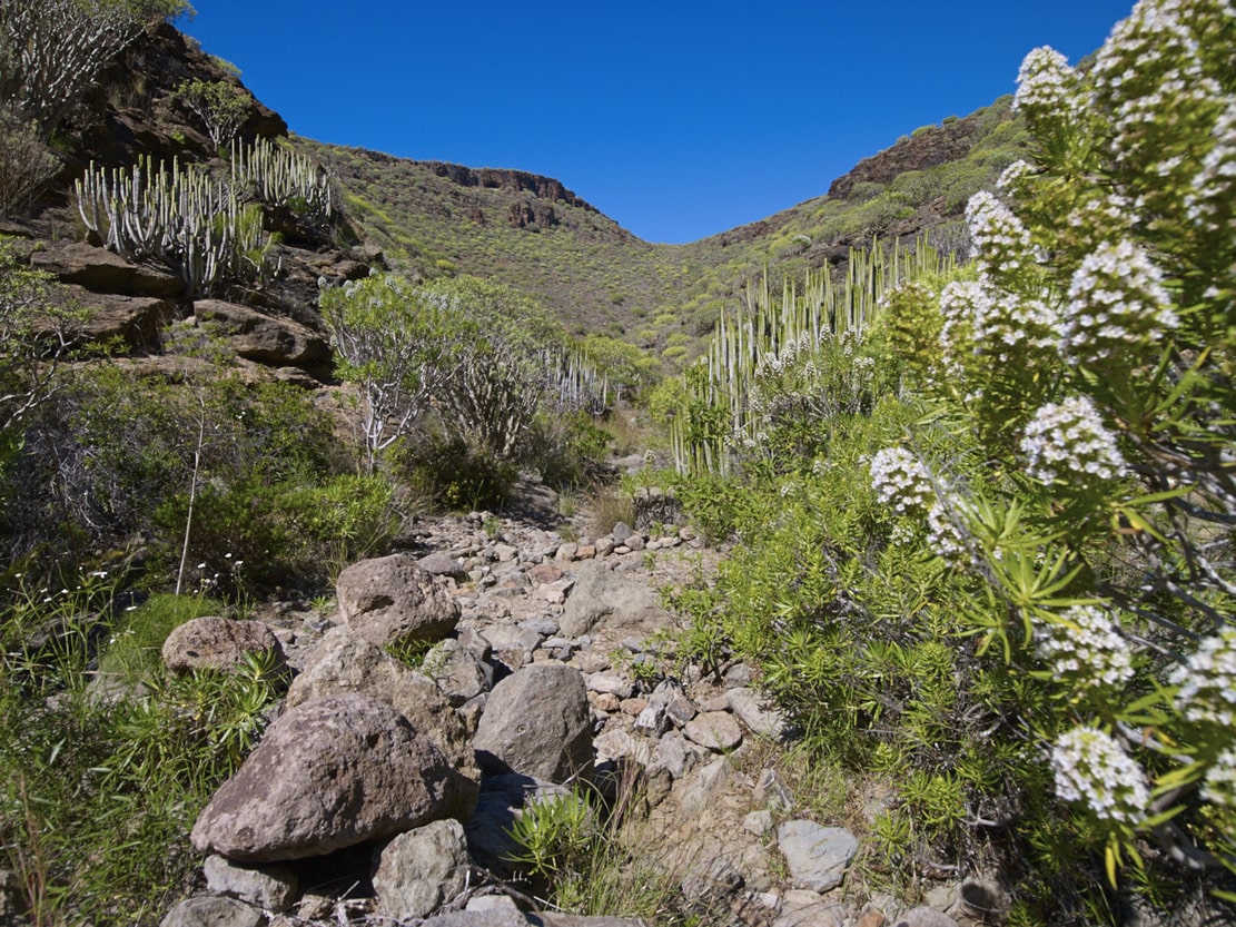
The route runs along the middle-lower part of the W slope of the Tauro ramp starting from the Hoya del Salitre; a gully that is excavated by sectioning the rocky summit of this slope, starting from the Puntón de las Leñas Buenas, where it takes the name of Cañada de Las Puntas, in two interfluves: the Llano de la Cáscara and the Lomo de los Revolcadores through which we will ascend. Despite the steepness of the slope, the ascent is pleasant thanks to the abundance of vegetation, also of the Cardonal-Tabaibal type.
In addition to tabaibas and taginastes, there are many sea rosemary, damselflies, buttonbushes and Mato cliffs. When we reach the Lomo de los Revolcadores the landscape changes. The toponym refers to the ancient use of the place as a beast wallowing place, as it is a flat place with no vegetation (M. Trapero, 1999). And indeed, the element that abounds is the loose flagstone (phonolite), present throughout the Ramp and sometimes piled up in turrets. Taking the opportunity to rest, we can look out to the east and see the Bco. de Taurito. From here the path becomes more bearable, with a gentle ascent towards El Guirre. On the way, we can see some loose pine trees, witnesses of the degradation of the pine forest and communities of sweet Tabaibas. In the past, the milk of the tabaibas (latex) was used for therapeutic purposes. A cut was made in one of the trunks and a container was placed underneath to collect the latex. Several days later it was collected, with the hardened paste ready to be chewed to improve oral hygiene.
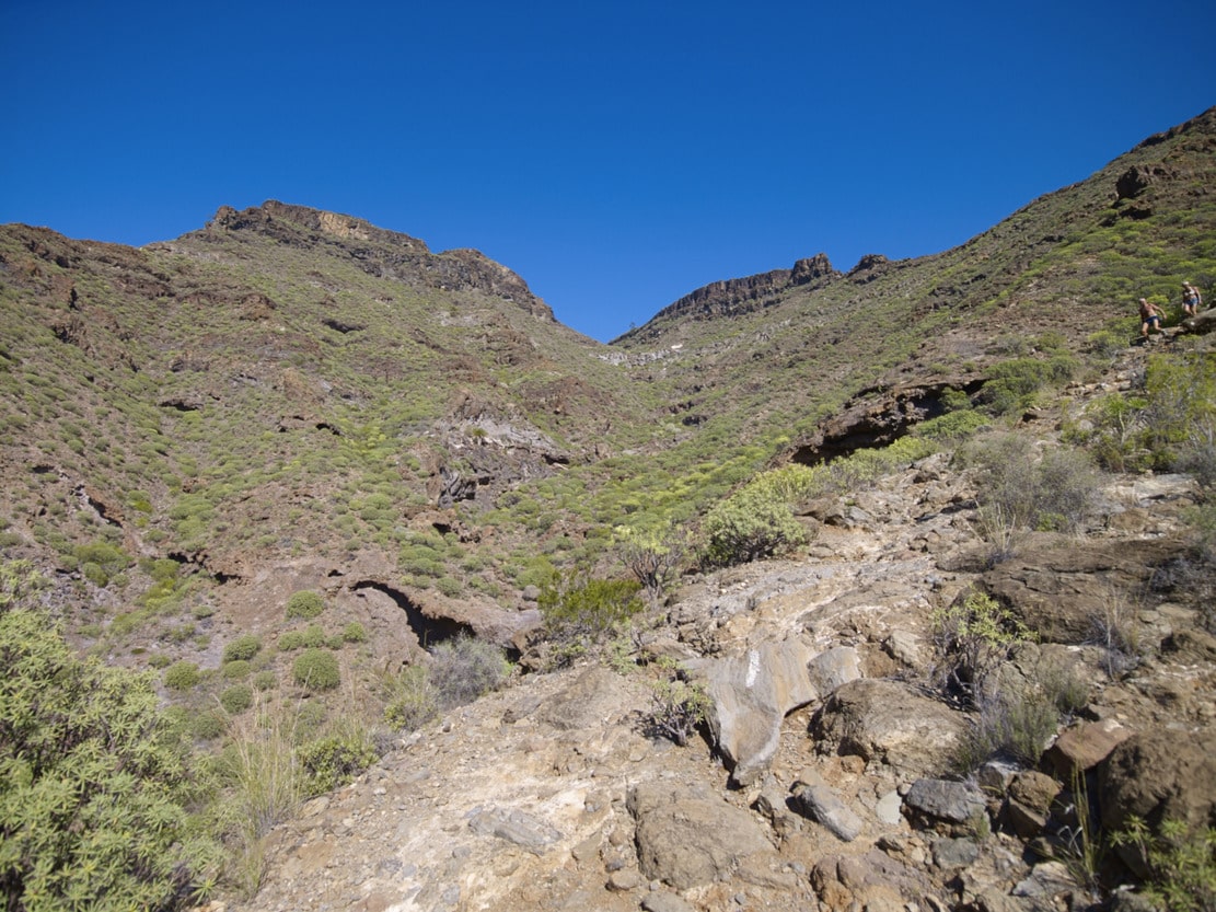
As we get closer to the crossroads in the Guirre area, we can observe a greater presence of shrubs, especially the Artemisa ramosa with its intense aroma similar to incense, typical of the dry hillsides. Towards Mogán we can see the impressive cliffs of this area: Puntón de la Leñas Buenas, Puntón del Guirre. (The name Guirre, which is widely used on this side of the ramp, refers to the presence of these birds of prey, which are now extinct in the area). The age of these escarpments is witnessed by the large fractures in their rocks, with capricious shapes, which seem to wait only for the wind or heavy rains to fall into the void.
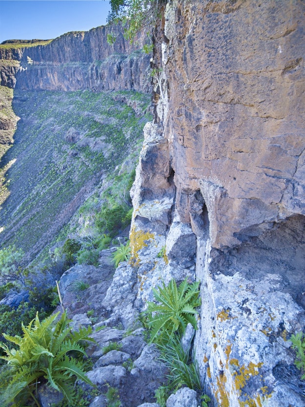
Once at the crossroads, we can glimpse the Laderones Pass (the augmentative suffix of “laderones” tells us of the great proportions of this escarpment). The path, uncovered by erosion, allows us to see some specimens of junipers hanging on the cliff. Downwards we zigzag along the gigantic slope covered with debris towards the mill that gives its name to the hamlet. We must begin the descent very carefully (be careful, it can be dangerous). When you reach the bottom, the satisfaction of overcoming an almost vertical slope compensates for the effort. Once the path is finished, we can rest in the mill (historical-ethnographic value). It was rebuilt after a fire at the end of the 19th century and nowadays, in addition to its own use (grain milling), it has value as an ethnographic resource and information point and can be visited.