R2
Los Azulejos - Los Quemados
Conditions: Optimum. Good signposting and good state of conservation. Pay attention to the cairns when crossing the ravines. Be careful at the beginning of the path in the first few metres of the climb, due to the steep slope and loose soil.

Features
6,68 km
Distance
3:30h
Duration
Moderate-High
Effort

Description
Section A: Azulejos-Llanos de Ojeda:
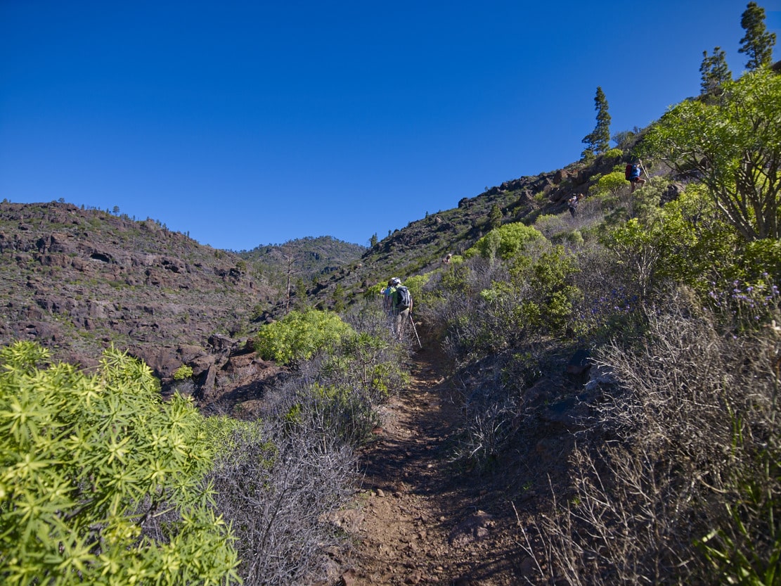
The access point is on the right-hand side of the C-819 road, from Mogán to La Aldea, at an inlet (Los Azujelos), where there is a signpost. The path starts zigzagging upwards from this point, encountering large stones on the way, with the Ojeda ravine on the left. Still ascending, we reach the Charcas de las Aneas. From there we climb up to Llano de la Bruma, a less steep area. The path, marked with cairns, turns off to the left of the Bco. de los Palos, until it connects with the track that heads towards the Aula de Inagua.
Section B: Llanos de Ojeda-Roque de Veneguera:
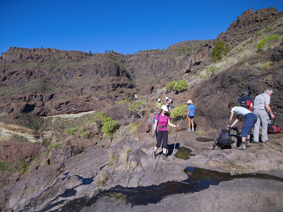
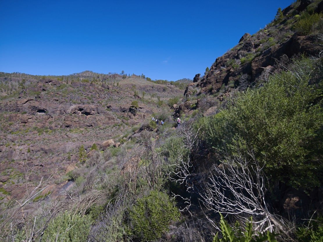
We walk along the track towards the E, in the opposite direction to the Aula de Inagua, going around the head of the Barranquillo de los Palos ravine, until we reach the Llanos de Ojeda. Cross these, carefully following the cairns that point to an old pine tree (the Pino de la Orilla), which indicates the beginning of the downhill path, covered with vegetation. We descend gently towards the Lomo de Los Quemados, where we can see some important waterfalls, crossing some ravines with flats and slopes. The Aula de Inagua can be seen on the right, as well as another view of Los Azulejos and route 1. Although the slope is not very steep, at some points it increases and is saved by the zigzagging of the path. We reach the Roque de Veneguera, which we border, to finish the route, on the C-819 road (Mogán-La Aldea) where the signpost is located.
Interpretation:
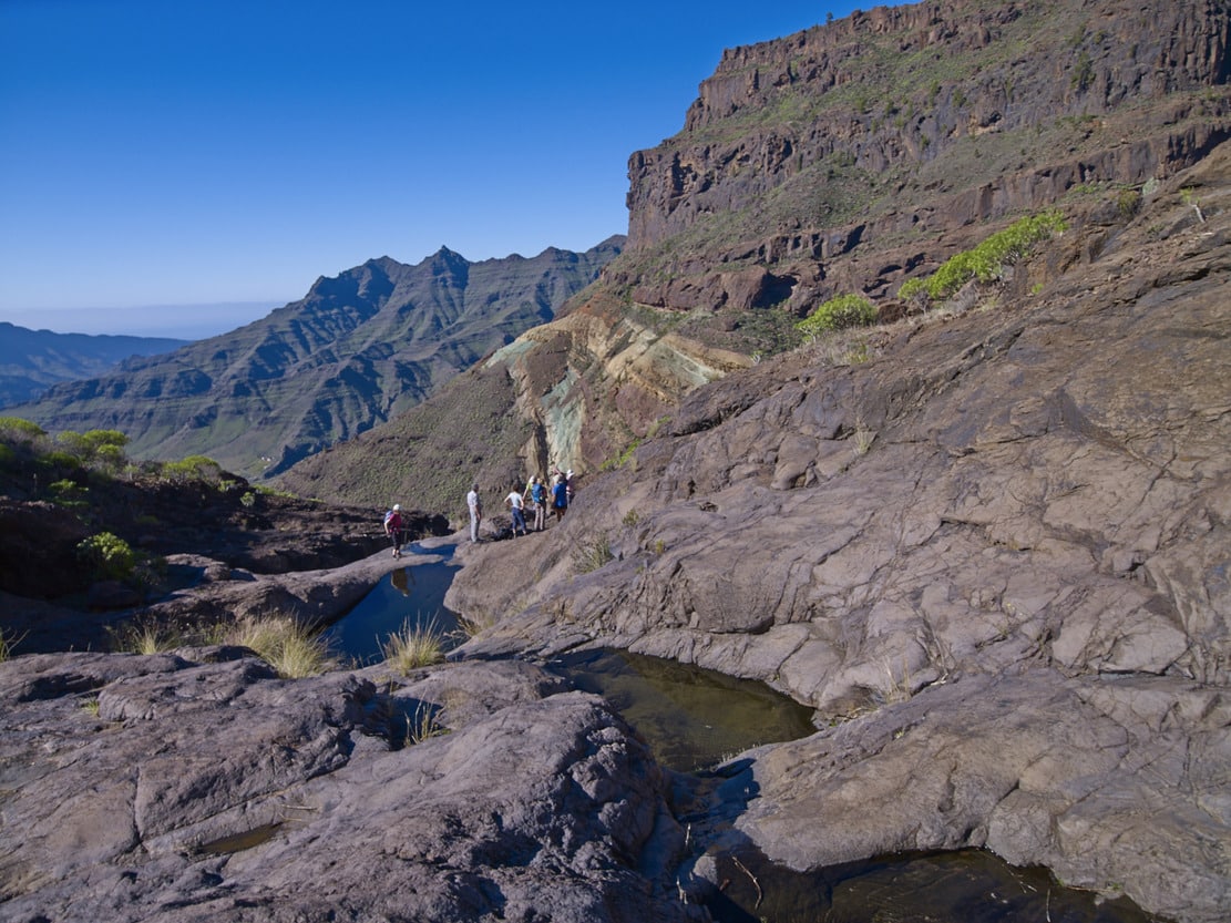
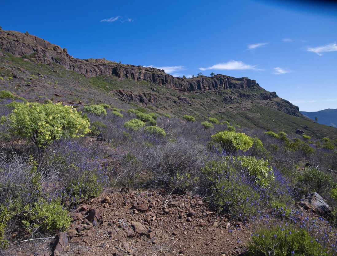
This route follows the ravines that form part of the headwaters of the Veneguera Valley, on the SW edge of the Inagua-Ojeda-Pajonales Massif. This is an ancient, Mio-Pliocene mountain range (trachytes, phonolites and basalts), highly eroded and culminated by a ridge or mountain range in an E-W direction, formed by several morros or mountains, including the Morro de Pajonales, Mt. de Alsándara or Sándara, (highest point, 1583 m), and the mountains of Ojeda and Inagua.
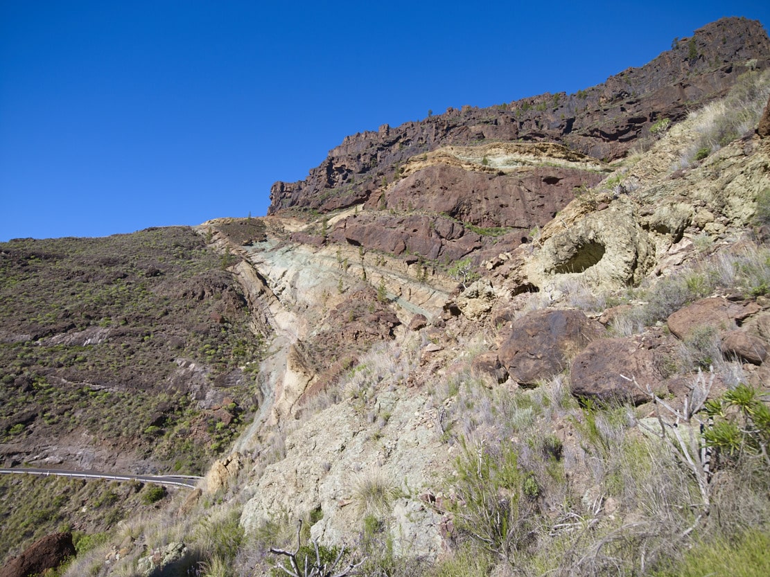
The colourful and striking rocks known as “Los Azulejos” (the tiles) are found in this part of the island (Risco de las Tederas and the ravines of Los Palos and Salobre), in greater numbers. In fact, they can also be seen in other places, defining the edge of the old Caldera* of Tejeda (W of Gran Canaria), which was formed by the collapse of the roof of the first volcanic building on the island and which was later filled in and re-excavated by other construction and erosion episodes respectively. The varied colouring of these rocks is due to hydrothermal alterations by contact with water and sudden cooling of volcanic tuffs* producing vitrification in different colours. Hence the name (M. Trapero, 1999) for similarity, of “azulejos” (glazed bricks of various colours).
After a short but steep ascent, we can rest in an area very polished by water where puddles form (Charco de “Las Aneas “* and “Charco Azul”, which is quite deep). They bear witness to the erosion caused by runoff from the massif and the torrential waters, albeit sporadic. Another sign of the strong erosion in this area are the small caves (taffonis) formed in the rocks by the action of the wind. Until we reach the plain of La Bruma, we can see plant species that have replaced the pine forest (rockroses, rockroses, thyme, taginastes, tabaibas, etc.), where it has been overexploited. Once here, we find a good formation of broom trees, which precede the later recolonisation of the pine forest.
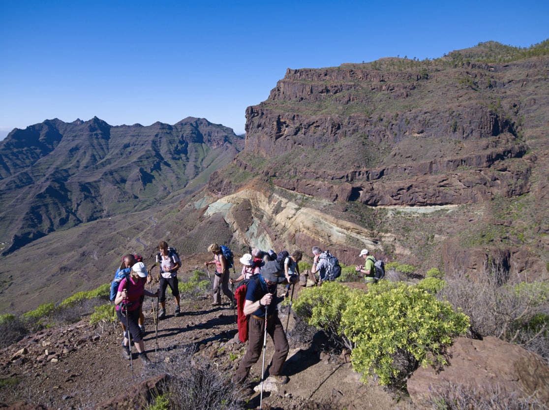
We ascend towards the Llanos de Ojeda, observing the first pine trees. They are old individuals, centenarians of great size and with a stunted crown, which have lost the conical crown typical of young pines. The Pinar de Inagua, Ojeda and Pajonales pine forest is a dry or southern exposure pine forest. Its specimens are scattered and the undergrowth is practically non-existent, unlike the Pinar de Tamadaba, which has a northern exposure. In general, this pine forest is in a good state of conservation, due to the fact that it has been protected by law since 1972 (Natural Hunting Refuge). In 1994 its limits were extended until the whole area was declared an Integral Nature Reserve (Law 12/1994 on Protected Natural Spaces), allowing only scientific and, exceptionally, educational use (this route is not within the protected area, it only passes along the boundary). The criteria for protection are the conservation of the pine forest and the fauna that inhabits it, especially the birds Picapinos and Blue Chaffinch, and we always identify Inagua with the natural pine forest. In reality, in other times it was exploited to obtain wood, coal, pitch or fish, for caulking ships, collecting pine needles for cattle bedding, etc. All these products were loaded on beasts (donkeys, horses, mules), along the paths and tracks along which we enjoy the landscape today. This makes us think of the hardness and suffering of the “work of yesteryear” with which the local population subsisted, along with agricultural work and shepherding.
We leave the Llanos de Ojeda and begin the descent towards Roque de Veneguera, through the area of Los Quemados and Lomo de La Palma. As we descend, the pine trees disappear in favour of the Cardonal-Tabaibal scrubland. As well as a beautiful view of the Tabaibales and Veneguera ramp, we can clearly distinguish the dyke that crosses the ravine and of which the Roque forms part, so called because it looks like a characteristic isolated monolith, but in this case it is one of the large remains of the dyke that has withstood erosion better, remaining as a projection. As we pass by it, we can see that it is colonised by rock vegetation, most of which is Cerrajas.