R5a
Tauro - Laderones
Conditions: Optimum: good signposting, good state of conservation. Despite the slope, the ascent to Mt. de Tauro is comfortable, as is the descent to Degollada de Las Lapas. The section from Guirre to Molino de Viento is more dangerous (see Camino 3).

Features
9,1 km
Distance
5h
Duration
High
Effort

Description
Section A: Salto del Perro Dam-Degollada de Las Lapas:
This starts on the road from Ayacata to Barranquillo Andrés (past the Las Niñas dam and the Cruz de San Antonio) or from the Mogán bank via Albarianes. The entrance to the path is clearly marked by a cairn. We start the ascent up the Tauro Mountain until we reach the Fuente del Durazno (a wide esplanade that opens up at a bend in the path). From this point, the zigzagging ascent takes us to the summit, with the option of approaching the Almogarén or Tagororor, along a path on our left. The route continues gently downhill to Degollada de Las Lapas, where there is an old abandoned forestry house used as a shelter for rangers and shepherds. This pass is a crossroads of paths: to the SW, the path to the Llanos del Guirre (Laderones/Molino de Viento, Hoya del Salitre) and to the E, leaving behind a first milestone next to the house, we come to another milestone, about two hundred metres along the Cañada de la Salvia, which points us in two directions: heading E, we connect with the path to Cortadores, and heading S, we head towards the Llanos de Gamona.
Once we reach Degollada de Las Lapas, we have two alternatives to reach Guirre: the section of the Llanos of the same name or the section that descends to the Llanos de Gamona and Bco. de Taurito, taking a very interesting detour, to then descend towards Molino de Viento.
Section B: Degollada de Las Lapas-El Guirre:
The path is clear and well signposted, and continues gently downhill, almost flattening out. As you go on, you can see some Canary Island pine trees and also some cardoncillos, as well as another dry stone house, which has collapsed. Continue along the path and you reach the Fuente del Guirre fountain, leaving the Bco. de Taurito on your left. We continue until we reach a dry stone corral in the Laderones Pass.
Section C: Laderones Pass – Windmill
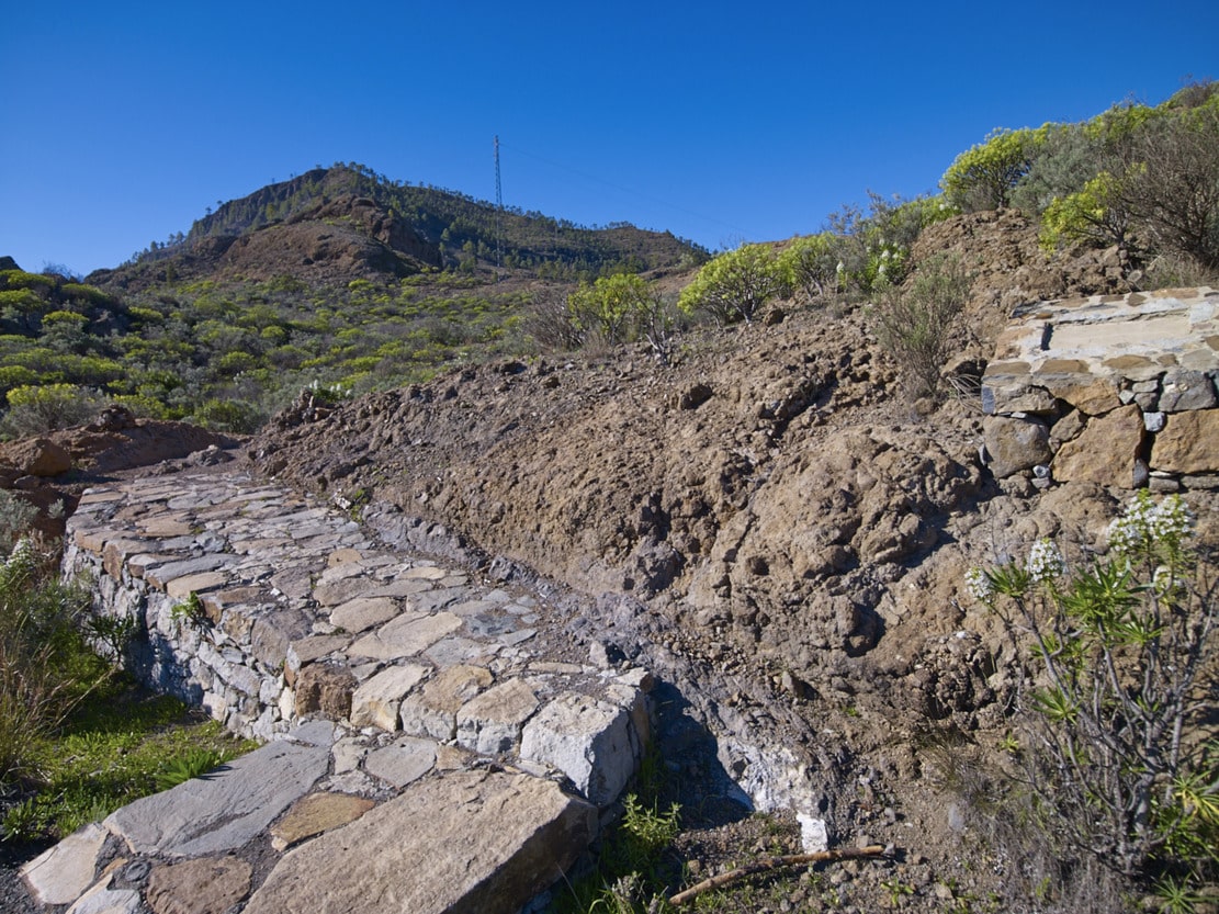
From the sheepfold, we descend steeply down a paved path. Then it flattens out a little on the platform, to zigzag down again (pay attention to the strain on your knees and feet). The path ends at a dirt track (signpost) that connects with an asphalted section (approx. 500 m), which leads to various farms and the C-812 road, in the village of Molino de Viento.
Interpretation:
Presa de Salto del Perro-Degollada de Las Lapas:
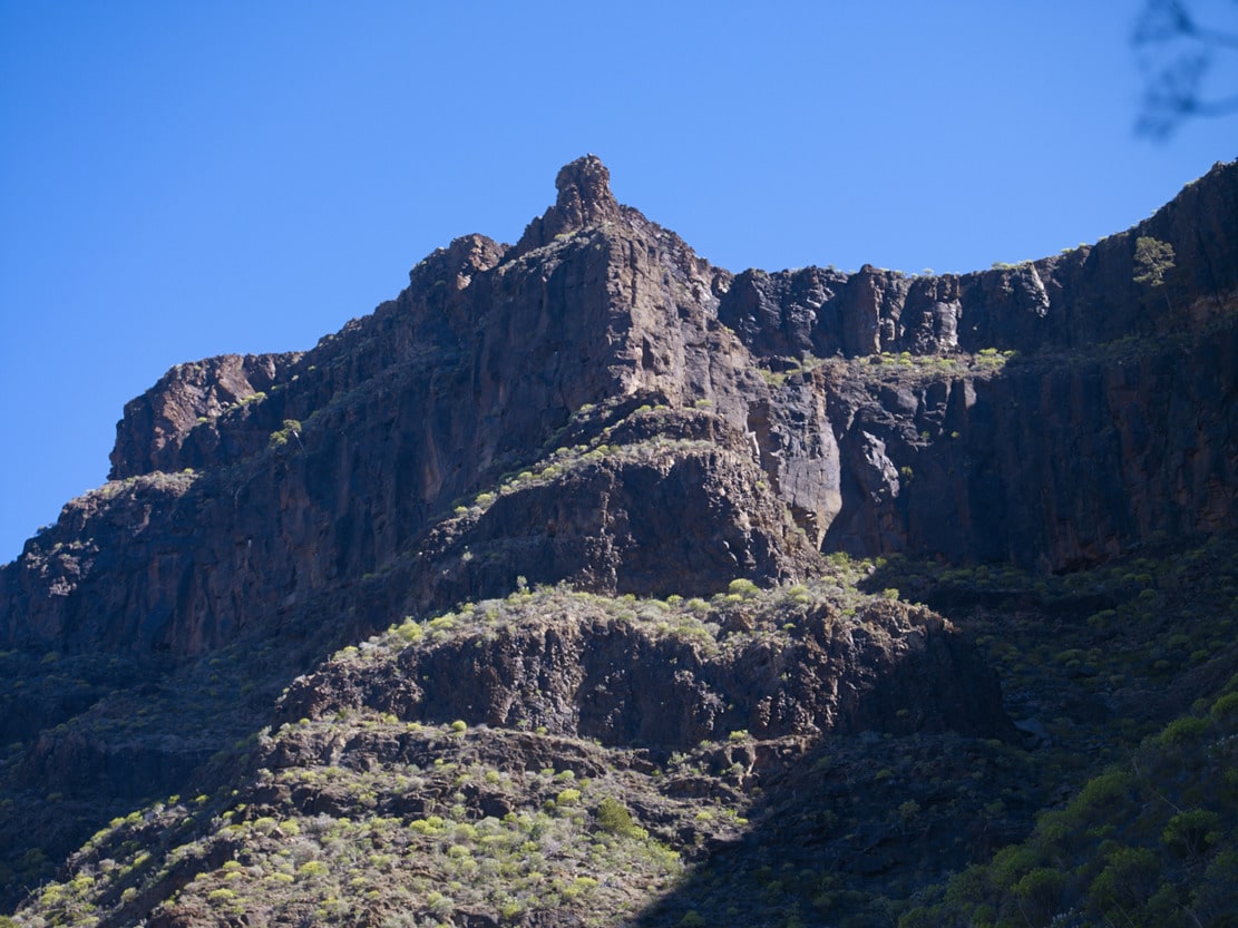
We leave the Salto del Perro dam behind us, to take the path that climbs Mt. de Tauro. Early in the morning, the mountain will appear to us like a sleeping giant that is beginning to wake up; the lower half in shadow and the upper half in reddish colour, in contrast with the bright green of the pines, due to the sunrise.
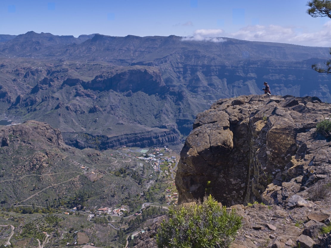
When we reach the top of the Fuente del Durazno, we can stop for a moment to stretch out and enjoy a magnificent panoramic view (almost circular) crowned by the head of Mogán Bank, with the Mt. de Aslobas and the Teide in the background up to the Santidad ramp, to the SE. In the foreground, filling the space between the Inagua-Ojeda-Pajonales Massif and the Tauro Ramp, we can see the Majada Alta plains.
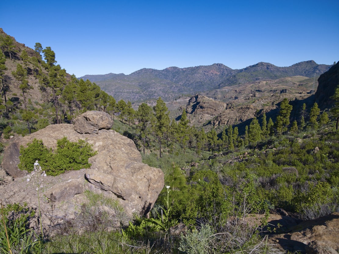
We continue our ascent to the mountain along a relatively narrow path, first among scrubland (cardonal-tabaibal) and, as we approach the summit, among pine trees. The “lágrimas de la virgen”, with their characteristic little white flowers, stand out in the undergrowth. Witness to the forestry activity of the past, on the left of the path you will find the remains of a pitch oven, where the resin from the bark of the pine tree was used to obtain pitch or pitch for caulking ships. Near the summit, we can also make out the Guguy Massif, with the Hogarzales Mountain and the Cedro Mountain in the background towards La Aldea. If we visit the site of “La Iglesia de los Canarios” (we must be as respectful as possible), we will be able to understand the more than probable religious meaning of the site, due to the mysticism of the place, with a very beautiful panoramic view. Back on the path, from the stone wall that shows us the way, we can see towards the sea, the whole ramp that opens up in a fan, with the great plains interrupted (del Guirre, to the W, and Gamona to the E), by the incision of the ravines of Taurito and Tauro.
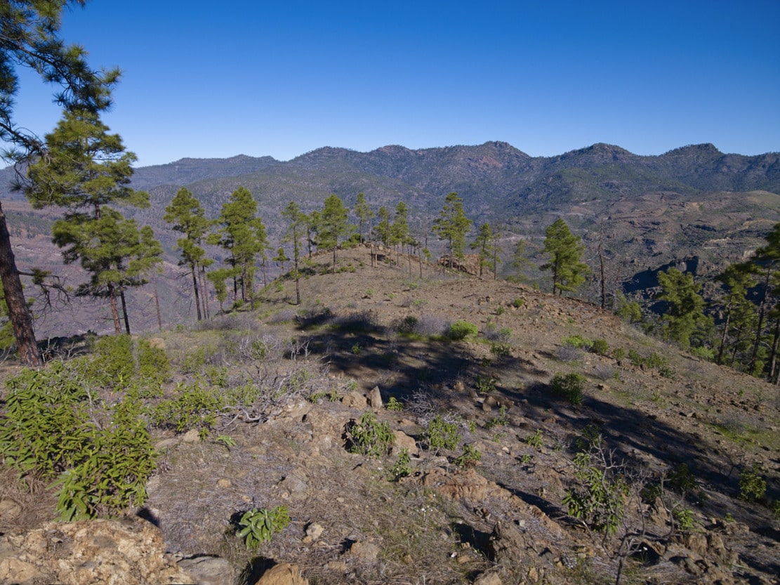
As we leave Mt. de Tauro, the pine forest opens up, leaving “patches” of pine trees, some of which are also loose or in pairs. And once again the bushes begin to appear; now the cardoncillos stand out, all along the ramp, with their characteristic greyish green colour. But the most curious and outstanding feature of the path are the flagstones, produced by the erosion of the trachyphonolitic material of the ramp, which will also accompany us on practically all the paths along the ramp, like a little music caused by the percussion of our footwear against the ground. This sound gives rise to the name of these rocks: phonolites (“fono”=sound, “lita”=stone).
After a moderately steep but short descent, you will reach the Degollada de Las Lapas. On the right hand side, some fifty metres to the W after the half-ruined house, there is a balcony or viewpoint towards Mogán (beware of the precipice and vertigo). A typical characteristic of the cut-throats is the whip of the wind that blows from one slope to the other, making the contrast between one slope and the other more noticeable.
Degollada de Las Lapas-Llanos del Guirre-El Guirre:
This section runs almost in a straight line along a steep ridge, which is actually the W edge of the Tauro ramp and which in some places rises to form very steep ridges (slopes of the Bco. de Mogán). In fact, along the way we can constantly look out over the cliffs (with care) and see the Mogán valley in the background and, above it, the Tabaibales ramp, with the Punta de Tabaibales, which crowns this structure, being more clearly visible. Under one of these viewpoints, there is a dragon tree (Dracaena draco), practically hanging on the cliff. There are also other smaller ones, which belong to the endemic species of the island recently discovered by technicians of the Cabildo Insular (Island Council) and called Dracaena Tamaranae. There are also some junipers and rupicolous pines that take advantage of some rock ledges or platforms.
In the Llanos del Guirre, a rocky landscape predominates, interrupted by some groups of pine trees. There is an abundance of bitter tabaibas and white tajinastes, some rockroses, incense, etc.
The vegetation is generally xeric, adapted to very poor or shallow soils (lithosols). Caves (taffonis) have formed in the crags due to the erosive action of the wind, which have also been used by shepherds. An example of this is the Cueva de los Gatos, located in the Puntón del Guirre, which is currently in poor condition due to the incursions of unscrupulous people.
El Guirre – Laderones – Windmill:
When you reach El Guirre, you will find a circular stone wall (a sheepfold) which also bears witness to the livestock farming activity practised in Tauro and Mogán.
Once at the crossroads, we can see the Laderones Pass (the suffix “laderones”, which is an augmentative suffix, tells us of the great proportions of this escarpment). The path, uncovered by erosion, allows us to see some specimens of junipers hanging on the cliff. Downwards we zigzag along the gigantic slope covered with debris in the direction of the mill that gives its name to the hamlet. We must begin the descent very carefully (be careful, it can be dangerous). When you reach the bottom, the satisfaction of overcoming an almost vertical slope compensates for the effort. Once the path is finished, we can rest in the mill (historical-ethnographic value). It was rebuilt after a fire at the end of the 19th century and nowadays, in addition to its own use (grain milling), it has value as an ethnographic resource and information point and can be visited.