R5b
Tauro - Taurito - Laderones
Conditions: Optimum: good signposting, good state of conservation. Despite the slope, the ascent to Mt. de Tauro is comfortable, as is the descent to Degollada de Las Lapas. The section from Guirre to Molino de Viento is more difficult.

Features
12 km
Distance
5h
Duration
Alto
Effort

Description
Section A: Salto del Perro Dam – Degollada de Las Lapas:
See description of this section in route nº4.
Once we arrive at Degollada de Las Lapas we have two alternatives to reach the Guirre: the section of the Llanos de Las Lapas or the section that descends to the Llanos de Gamona and the Bco. de Taurito, making a very interesting detour, and then descends towards Molino de Viento.
Section B: Degollada de Las Lapas – Llanos de Gamona:
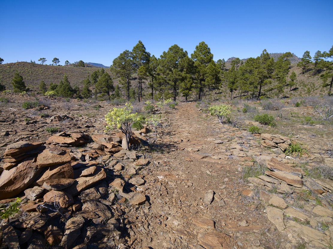
The path runs along a flat, well-surfaced and clearly signposted path, continuing on a gentle descent to reach the Lajas de Medina, where we can see piles of stones (slabs) that may confuse us with the cairns that mark the path (caution), until we reach the Llanos de Gamona. Here we come across a dirt track for private use coming from the mouth of the Bco. de Tauro. At the end of this section, we can also see the milestone that announces a new crossing of paths: to the W, the path that goes to the Llanos del Guirre, crossing the Taurito Bank, and to the E, the path that goes down the impressive Tauro Bank, towards the Tauro Houses.
Section C: Llanos de Gamona – Charcas de Taurito – Llanos del Guirre:
From the Llanos de Gamona we take the path to the west through a small ravine, the Caidero Negro, after which we head towards the bed of the Taurito riverbed going down its right bank (Umbría del rincón de Taurito). Bordering a flat platform along the clear and wide path, we reach the riverbed to cross to the other side and zigzag up the Andén Colorado, until we reach the Llanos del Guirre where we find a large cairn. We continue in a W direction without a defined path (pay attention to the cairns), crossing a small ravine to link up with the crossroads that directs us towards Laderones (SW) on this route, or towards Degollada de Las Lapas (N, indicative cairn).
Section D: Laderones Pass – Windmill:
From the sheepfold, descend steeply down a cobbled path. Then it flattens out a little on the platform, to zigzag down again (pay attention to the strain on your knees and feet). The path ends at a dirt track (signpost) that connects with an asphalted section (approx. 500 m), which leads to various farms and the C-812 road, in the village of Molino de Viento.
Interpretation:
Presa de Salto del Perro-Degollada de Las Lapas:
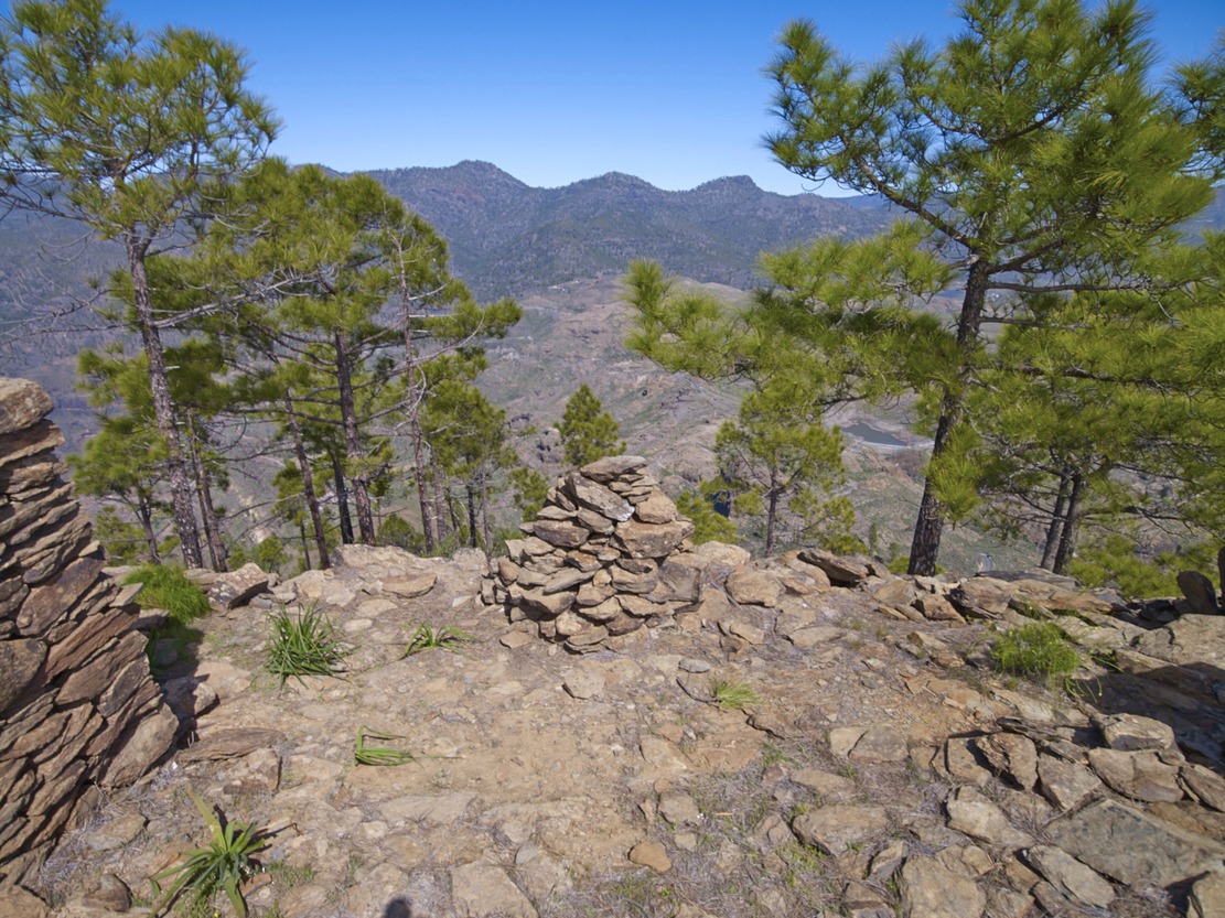
We leave the Salto del Perro dam behind us, to take the path that climbs Mt. de Tauro. Early in the morning, the mountain will appear to us like a sleeping giant that is beginning to wake up; the lower half in shadow and the upper half in reddish colour, in contrast with the bright green of the pines, due to the sunrise.
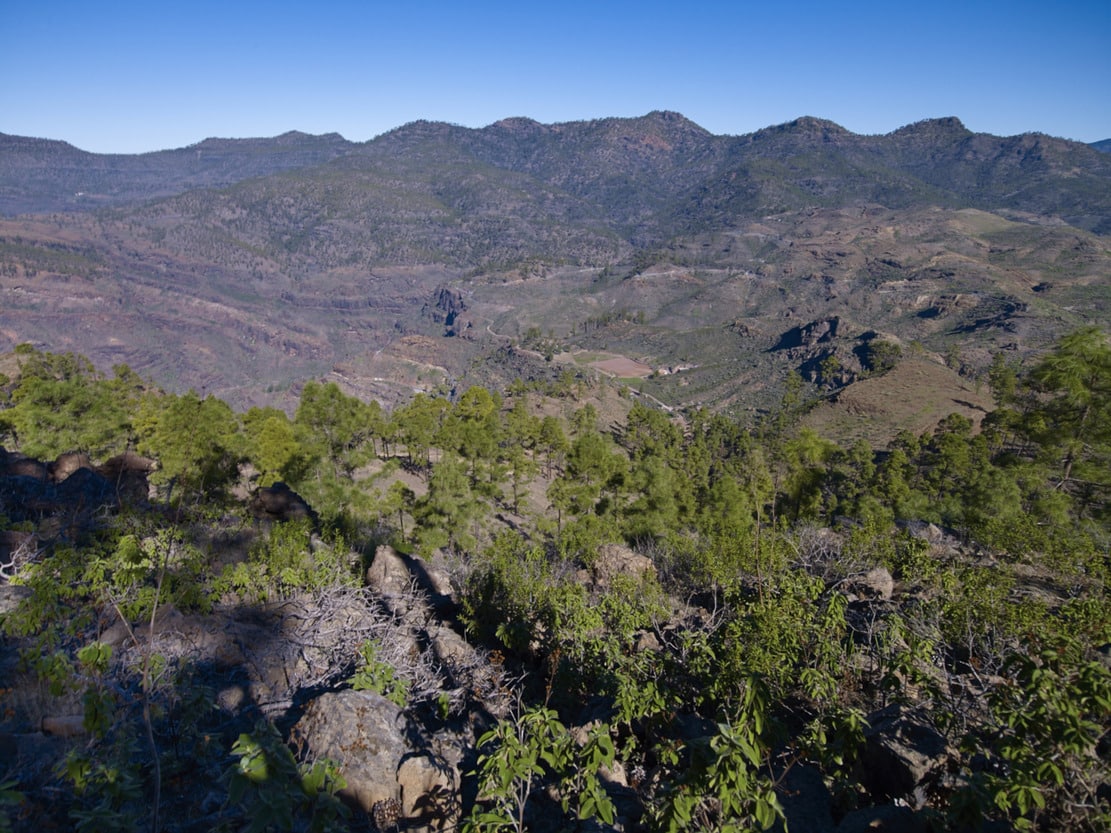
When we reach the top of the Fuente del Durazno, we can stop for a moment to stretch out and enjoy a magnificent panoramic view (almost circular) crowned by the head of Mogán Bank, with Mt. de Aslobas and Mount Teide in the background up to the Santidad ramp, to the SE. In the foreground, filling the space between the Inagua-Ojeda-Pajonales Massif and the Tauro Ramp, we can see the Majada Alta plains.
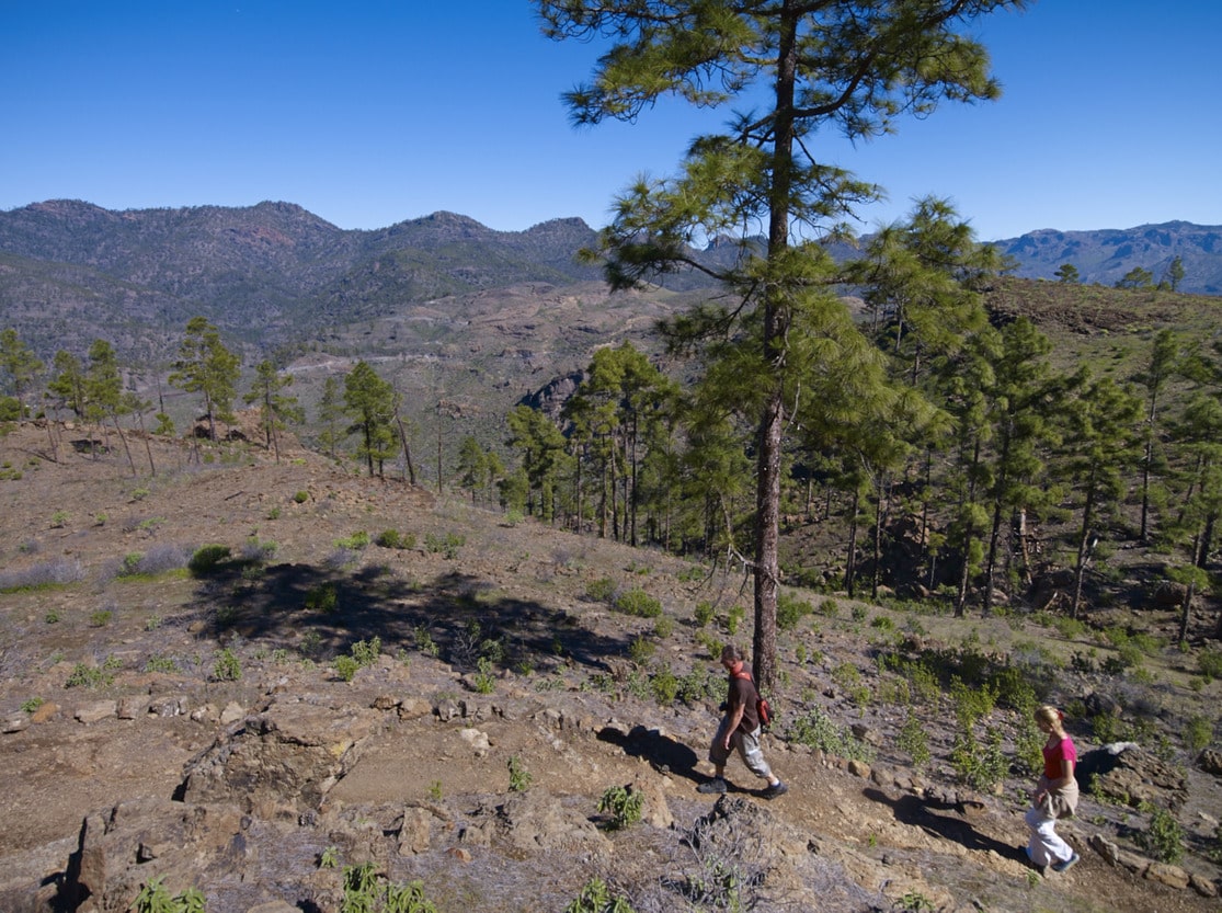
We continue our ascent to the mountain along a relatively narrow path, first among scrubland (cardonal-tabaibal) and, as we approach the summit, among pine trees. The “lágrimas de la virgen”, with their characteristic little white flowers, stand out in the undergrowth. Witness to the forestry activity of the past, on the left of the path you will find the remains of a pitch oven, where the resin from the bark of the pine tree was used to obtain pitch or pitch for caulking ships. Near the summit, we can also make out the Guguy Massif, with the Hogarzales Mountain and the Cedro Mountain in the background towards La Aldea. If we visit the site of “La Iglesia de los Canarios” (we must be as respectful as possible), we will be able to understand the more than probable religious meaning of the site, due to the mysticism of the place, with a very beautiful panoramic view. Back on the path, from the stone wall that shows us the way, we can see towards the sea, the whole ramp that opens up in a fan, with the great plains interrupted (del Guirre, to the W, and Gamona to the E), by the incision of the ravines of Taurito and Tauro.
As we leave Mt. de Tauro, the pine forest opens up, leaving “patches” of pine trees, some of which are also loose or in pairs. And once again the bushes begin to appear; now the cardoncillos stand out, all along the ramp, with their characteristic greyish green colour. But the most curious and outstanding feature of the path are the flagstones, produced by the erosion of the trachyphonolitic material of the ramp, which will also accompany us on practically all the paths along the ramp, like a little music caused by the percussion of our footwear against the ground. This sound gives rise to the name of these rocks: phonolites (“fono”=sound, “lita”=stone).
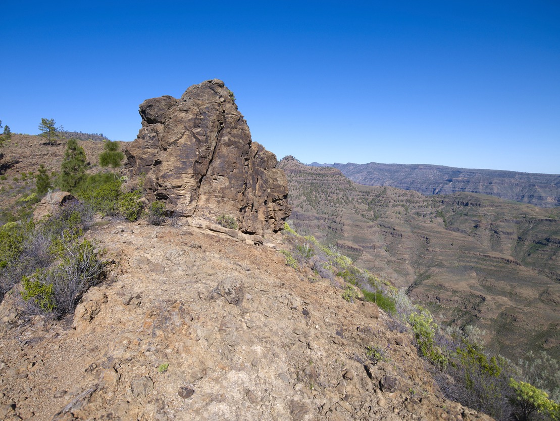
After a moderately steep but short descent, you will reach the Degollada de Las Lapas. On the right hand side, some fifty metres to the W after the half-ruined house, there is a balcony or viewpoint towards Mogán (beware of the precipice and vertigo). A typical characteristic of the cut-throat areas is the whip of the wind that blows from one slope to the other, making the contrast between one slope and the other more noticeable.
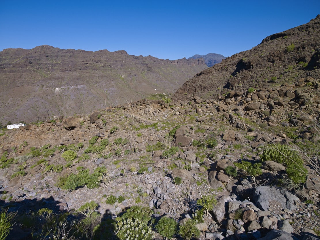
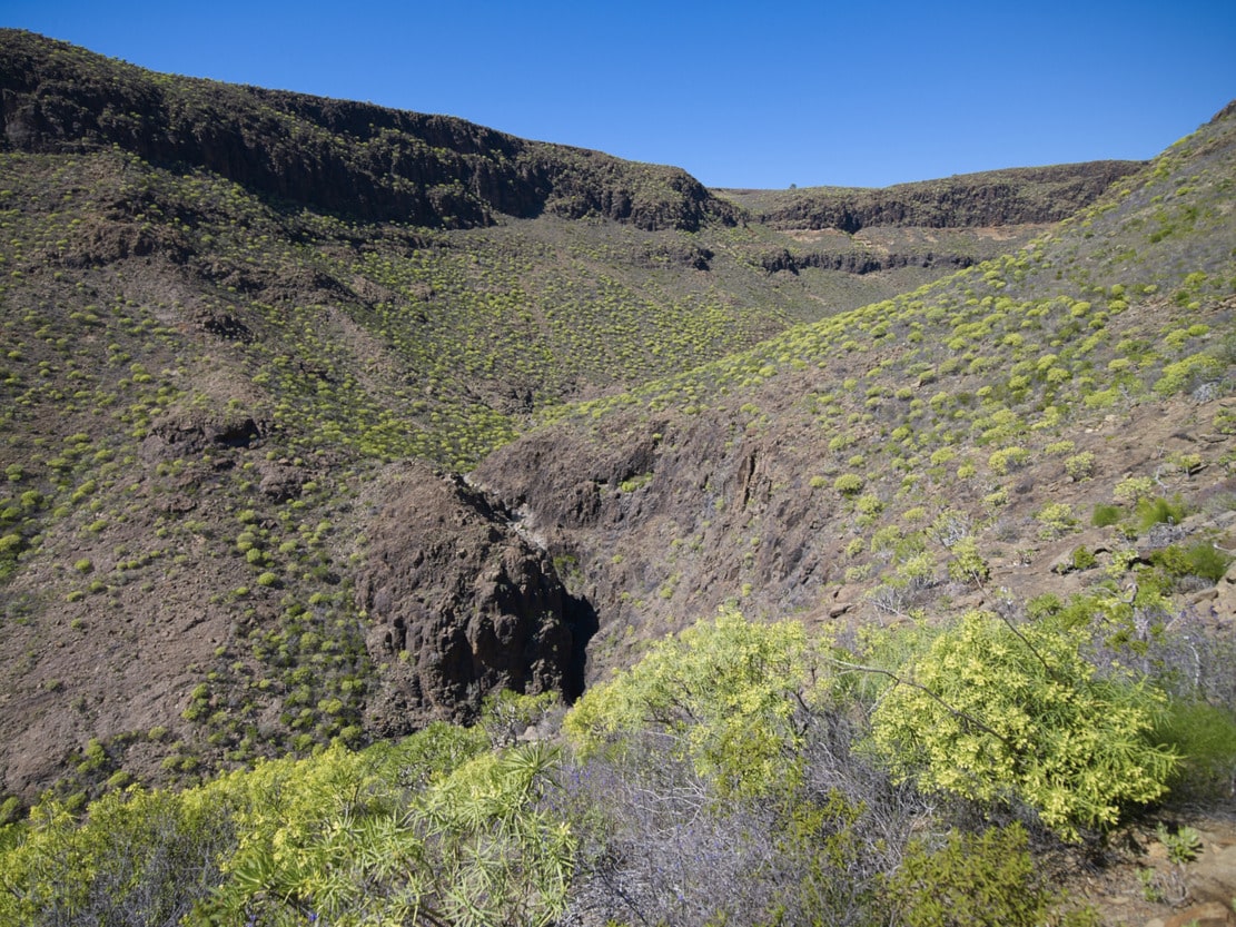
Heading towards the Llanos de Gamona, we go round the Cañada de Las Lapas (head of the Taurito bank), among pine trees, to continue along a small knife, which allows us to look out and see the large gorge caused by the incision of the Tauro Bank. This narrow spine widens further on, forming large plains (called “lomos amesetados”), known as the Lajas de Medina and the Llanos de Gamona, in which, as their names indicate, what predominates in the former is a landscape of rocks dotted with cardoncillos, tabaibas and taginastes; and probably, the name “Gamona” of the latter plain refers to the presence of this plant associated with the pine forests. From the Lajas de Medina there is a good view of the lower part of the ramp and the coastal towns (Arguineguín, Puerto Rico) can be seen in the distance.
Degollada de las Lapas – Llanos de Gamona – Charcas de Taurito – Llanos del Guirre:
Heading towards the Llanos de Gamona, we go round the Cañada de Las Lapas (head of the Taurito bank), among pine trees, to continue along a small knife, which allows us to look out and see the large gorge caused by the incision of the Taurito Bank. This narrow spine widens further on, forming large plains (called “lomos amesetados”), known as the Lajas de Medina and the Llanos de Gamona, in which, as their names indicate, what predominates in the former is a landscape of rocks dotted with cardoncillos, tabaibas and taginastes; and probably, the name “Gamona” of the latter plain refers to the presence of this plant associated with the pine forests. From the Lajas de Medina there is a good view of the lower part of the ramp and the coastal towns (Arguineguín, Puerto Rico) can be seen in the distance.
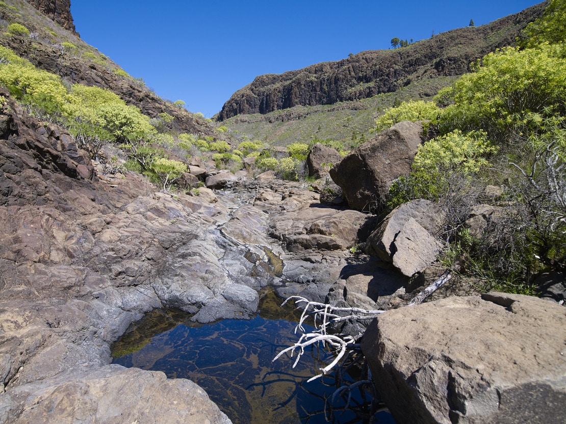
We have descended through the Lajas de Medina and now we head towards the Bco. de Taurito. This is a gentle stretch, with little gradient, thanks to the good layout of the path, until we reach the W side of the path (Andén Colorado, sunny slope). We are near the head of this ravine (Cañada de Las Lapas), just at the next section where it begins to have greater proportions, with a V-shaped profile and a very narrow channel interrupted by continuous jumps. It is in these falls that the “Charcas de Taurito” (Taurito pools) are formed in winter after the rains. If we are lucky enough to see them with water, they will make our walk even more pleasant. The predominant vegetation is the same (Cardonal-Tabaibal), although less developed than in the other sections described.
After overcoming the Andén Colorado we will enter the Llanos del Guirre, with very sparse vegetation and very stony ground.
Laderones Pass – Molino de Viento (Windmill)
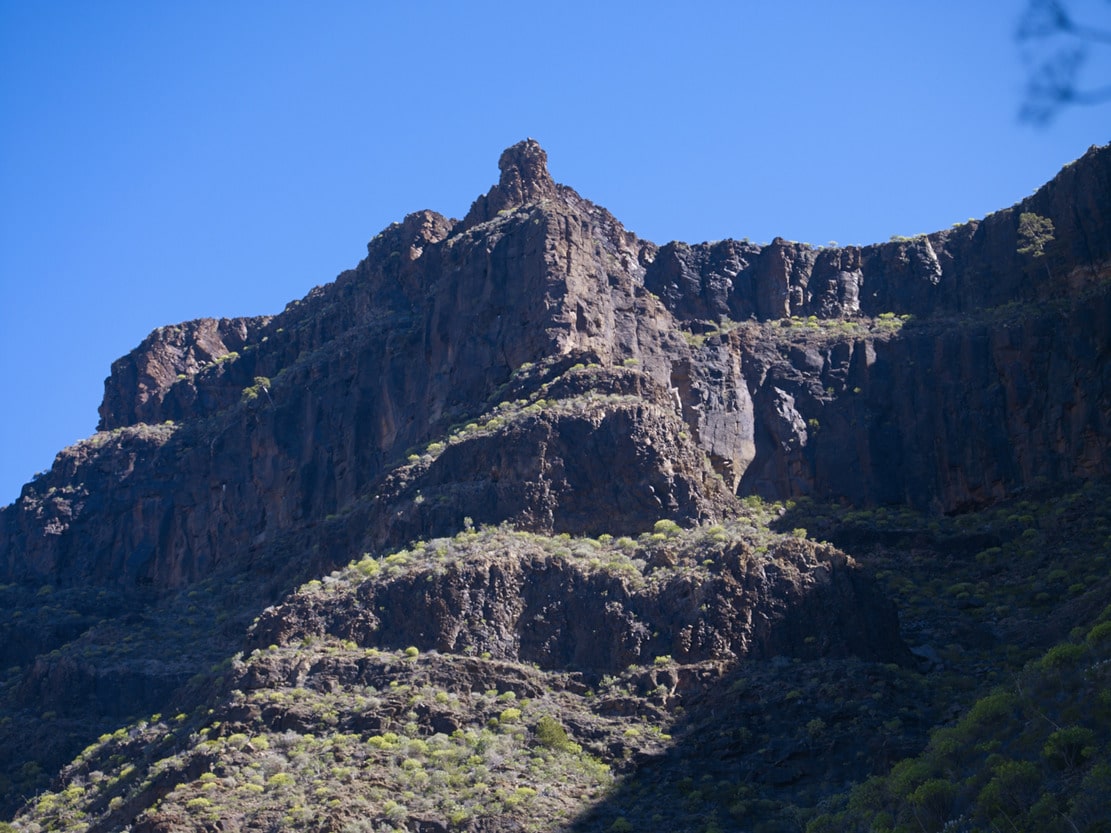
Once we reach the crossroads we can see the Laderones Pass (the suffix “laderones”, which is an augmentative suffix, tells us of the great proportions of this escarpment). The path, uncovered by erosion, allows us to see some specimens of junipers hanging on the cliff. Downwards we zigzag along the gigantic slope covered with debris in the direction of the mill that gives its name to the hamlet. We must begin the descent very carefully (be careful, it can be dangerous). When you reach the bottom, the satisfaction of overcoming an almost vertical slope compensates for the effort. Once the path is finished, we can rest in the mill (historical-ethnographic value). It was rebuilt after a fire at the end of the 19th century and nowadays, in addition to its own use (grain milling), it has value as an ethnographic resource and information point and can be visited.